Tuesday, October 8, 2024

E3: Varbiski Prohod Hut to Kotel: Day 7

A more difficult day than I expected due to a non-existent track, but arriving at Kotel and a posh hotel was made all the more pleasurable by my hardships.

After leaving the "Hut", which was empty apart from myself and one other, I walked through the Varbiski resort. Once it must have housed hundreds of holiday makers, but most of the buildings were now in disrepair or not functioning. It looked like a couple of places were serviceable, with the grass cut, although I found none with on-line booking for October.

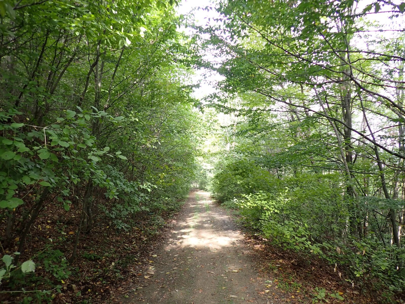
The guidebook promised an easy day and indeed, in the morning the tracks were good. Inevitably I was heading uphill but at least I could look forward to walking downhill in the afternoon. Beside the path was a narrow valley or ravine, but no water was flowing down its base. Likewise most of the "fountains" were dry today. For most of the day I was again walking through woodland. At its best the mature beech trees rose in architectural columns with a roof of green leaves high above me. Some of the beech forest is well over a hundred years old. I eyed the ground beneath them, free of undergrowth, that if flat would make a good campsite. However younger trees made attractive green tunnels for me to walk under.

This reminded me of an Impressionist painting.


An old sign for the Kom-Emine. 


A little snake.


In the afternoon, as I started downhill, I joined a single track road, its tarmac frayed at the edges or lost altogether. The Kom-Emine left it on an overgrown track. The cycle (i.e. Mountain Bike) option of the Kom-Emine continued down the road, perhaps I should have realised this was significant. Another clue was that the gpx track I had of another person's walk on this cross Bulgaria trail, which also lead down the road. In the event I followed the overgrown path. Initially a path was visible, beaten by both people and horses (I could tell from their poo and hoof prints). Then a fallen tree, small but with many branches, blocked the path. In attempting to get around, a thorn caused me to bleed slightly, eventually I crawled under the branches, the rucksack on my back breaking a few. Then I cursed myself when I realised an earlier side track was actually a diversion around the obstacle. Later, I found myself walking down the wrong side of a narrow valley. Seeing waymarks on a barely visible path on the other side I was forced to retrace my steps to follow the correct path, the valley sides being too steep to cross with dignity. Another kilometre added to my day!

Blocked path.

Reaching an area of grazing with multiple thorny bushes, the track disappeared entirely. My GPS tracks led me to impassable tree and thorn filled little valleys. After wasting much energy trying to find the way through I gave up. Not wanting to follow another non-existent track marked on my GPS, I consulted all the maps on my GPS and phone. Eventually I chose one that would take me to the road that the cyclists were told to follow. Even on this track, visible from satellites, I had a length of thorny blackthorn bushes to fight through.

The road was busy. Fast cars raced past me, there were a few lorries, mostly tank trucks, a man pushing an empty trolley uphill, another man filling a plastic bottle from a working roadside fountain, and two of the local horse and carts. The carts are small and narrow with rubber tyres, the horse can pull them over extremely rough terrain. If anything, they usually contain hay, no doubt fodder for animals, but one on the road today contained the driver's wife (I assume) and their dog.

Nearer the town of Kotel, the verge became increasingly littered. It seems a general problem. Occasional plastic bottles mark the trail, beer cans litter picnic sites, road verges are the depository of all kinds of rubbish. However such negative feelings were offset by passing a house, balloons tied to its fence, Arabic style pop songs playing, the family wiggling their bodies to the music, a happy sight, a birthday party perhaps. Not long after a bride and groom were walking up the road. The bride in full white wedding dress taking selfies, the groom in a smart suite with a neatly shaved, black beard. They were surrounded by a small group of people. A cameraman out front was recording the scene, a drum was beating, an accordion played and an Arabic instrument sounding like an oboe, but looking like a clarinet, was producing an evocative if nasal sound. Ladies broke off from the wedding party to offer chocolates to people watching on the pavement. I got two (chocolates)! Apparently I was in the gypsy quarter of town.

A wedding party in the gypsy quarter of Kotel.

My hotel was on the other side of town in a posher, less littered section. I choose a more expensive one, although cheap by British standards, as the reviews said English was spoken. On arriving I noticed they offered massages. My back, shoulder and neck were aching from the weight of my overfilled rucksack so after enquiring, within the hour I was laid out being kneaded and slapped. With food on offer I inevitably overeat, however I have probably not eaten enough in the last few days so a little gluttony can be justified.

Excluding places where I had to retrace my steps, the route I took today was 29 kilometres long with a 900 metre ascent.

Monday, October 7, 2024

E3: Rishki Prohod Pass to Varbiski Prohod hut: Day 6

I defeated overgrown paths, admired the sunrise and after much walking through woods am now at my first "hut" of the trip.

Rereading the guidebook last night I was alarmed that it claimed today was one of the most strenuous sections of the Kom-Emine trail. Yesterday I completed 7 kilometres of the 38 kilometres the guidebook suggested for today, but the most difficult parts of the trail were still waiting for me. Having read this and not wanting to arrive at the Varbiski hut too late, I started early, being away by 6 am. As sunrise was not until seven, this meant I began with the restricted area of light provided by my head torch. Fortunately the rain had stopped but there was a lot of mud on the tracks (as well as on my equipment as I packed up) which made them slippery, my trekking poles were invaluable to keep me from sliding over.

At first things went well but soon the route of the Kom-Emine turned south to join the alternate route I had found too slippery with mud yesterday. Unfortunately, the linking track no longer existed. I found where it once was, there was a waymark on a post a little way up it, but to go beyond this last hint of a path I had to force my way through saplings, fallen trees and other obstacles in the dark. Fortunately the distance I had to cover was not great, and although it took a lot of energy with much backtracking to find a way through, I did succeed. 

There was then a well waymarked path through the trees which lead up to a ridge where the ground dropped away to the north. At a rare viewpoint I was given the present of seeing the sun rise over the mountains, its shafts of light painting patterns in pink light on the trees. A reward for my struggles with long departed paths. I also admired the many honesty plants in the area.

Sunrise.

For most of the morning it was a mixture of passable and overgrown forest tracks. When walking through the latter, brambles grabbed at my trousers, branches brushed my bended head and my face tangled with surprisingly strong spiders' webs. I stumbled on hidden branches and on uneven ground dug up by some creature (wild boar maybe). There were also hills to climb; steep, pathless descents, and soft, soupy mud where forestry vehicles had churned up the tracks.

One of the better forestry tracks.

Conditions improved as I approached a group of forestry buildings. My hoped for picnic table was absent but a little after, leaving the main track for a little used one, a warm outcrop of rock was exposed where the track forded a shallow brook. I sat down there for a lunch snack, confident that no vehicle had come this way for many months. I was proved wrong, a forestry vehicle approached and I had to quickly move out of the way with all my stuff.

The track then climbed, gaining 200 metres in height. Just a few months ago, crossing the Alps on the GR5 I had managed this with, if not ease, without too much strain. However today it was a struggle, I was glad to reach the top and know I had a rest day after tomorrow's hike. Twice today I had passed small wooden boxes attached to trees marked "Aptechka", which means I think a First Aid Kit, and "Bulgarian Community Board". The boxes had a little roof with solar panels and a USB connection. Inside were a bottles and packets encased in cobwebs, as the writing on them was Bulgarian I was unsure their purpose. 

A lengthy walk through attractive woods led me to the Varbiski area. Among a group of buildings that could do with renovation there was an unexpected "Bistro" with an "open" sign flashing red. It was empty but for the owner. I stopped for a Coke and an ice cream before starting up the two kilometres of traffic less road to the Varbiski Prohod Hut. Lyuben from Bulguides sent instructions as to which room to go to, where a plate of sandwiches awaited me for my tea. I was instructed to leave 50 BGN for the food and accommodation. As a special treat, I had a shower, my first in five days.

31.5 kilometres walked today with a 1300 metre ascent.


Sunday, October 6, 2024

E3: Planinitsa to Rishki Prohod Pass: Day 5

A wet and tiring day.

I thought the day started well, a little rain overnight but not enough to cause problems. A mist gave the trees an ethereal charm. As I wanted a good wash I packed and walked to a "fountain" to brush my teeth and wash my face and underarms. Today's walk was among trees, the trail curved ahead of me, out of sight, a green corridor rising and falling across the terrain (but mostly going up it seemed to me). However I soon tired, the days of 30 kilometre walks taking their toll. My rucksack dug into my shoulders. Its weight was partly because I had packed for the cold, however so far it was unseasonably warm. I stopped at a sheltered picnic table for a rest, there are a few scattered along the trail. This one was a bit dilapidated. A old sign warned it was protected by CCTV which I doubted.

Mist gave the trees an ethereal air.

Early on I saw, on a distant patch of grass, two shepherds with a large flock and a barking dog. I thought this might be the only people I saw today, but was wrong. At midday I caught up with a large Bulgarian walking club out for a Sunday ramble. There was a Dutch man among them who spoke English. He was visiting a friend in Bulgaria and joined the outing. This first group were completing a shorter route, later I encountered the second part of the walking group completing a longer circuit. One of the ladies spoke to me at length in Bulgarian despite my making clear I could not understand her. She did however point out a fire salamander on the track.

About this time the forecast rain began. Accompanied by thunder, it was torrential at times. I stopped in "Hazim the Forester's Shelter" to have some lunch and wait for the rain to ease. The shelter had been kitted out with two layers of wooden sleeping platforms so you could stay the night there. A pile of dry wood was placed in front of the fire place ready to create a warm glow. It seemed attractive with the storm outside, but it would leave too far to walk to the hut I had booked tomorrow. 

Inside "Hazim the Forester's Shelter", sleeping platforms on the right, fireplace on the left.

After following a ravine, which I would have admired if it were not raining so hard, I had to walk up a road to Rishi Prohod Pass. Not a pleasant experience. Large lorries, some with trailers, were going up and down the road through multiple hairpin bends. I pressed myself into the crash barriers when they passed. At least they were moving slowly unlike the cars racing over the pass.

Finally, leaving the road I had two alternatives. I started up the first but the mud was extremely slippery in the rain. The second, longer route had a firmer surface. Although I was planning a few more kilometres I was tired, my shoulders ached, and I was wet. Excluding diversions I had only walked 22.3 kilometres today. Pitching my tent on a flattish patch among the trees, I had trouble getting the pegs to hold in the soft, wet earth beneath the leaf litter. I am hoping it is not windy tonight, especially as the rain is forecast to continue to the early hours. Everything is damp and muddy.


Saturday, October 5, 2024

E3: Topochiysko to Planinitsa: Day 4

The villages were more interesting today, with a Turkish and Muslim heritage. 

When camping in the woods, on dark moonless nights, you are surrounded by the sounds of creatures you cannot see. The droning, buzz of cicadas, the crash of broken branches nearby as an unknown animal makes its way through the woods, the howling of a creature sounding like a wolf, a distant barking dog or the whine of a motorbike coming down a nearby track. Last night there was also distant music in the evening, then this morning, before it was light, Arabic music, which at first I took to be the Muslim call to prayer. However it continued for too long and the cadence was dissimilar to the calling of a Muezzin.

Road walking.

The first part of the day was along tarmac roads, passing a few villages, their houses with red tiled roofs and usually white walls. Slightly more prosperous than those yesterday, and more compact, without the abandoned houses slowly falling apart, although still with chickens running around and side roads lacking tarmac. In Dobra Polyana the café was open for a morning coffee. I entered through plastic streamers into a smoke filled area full of men, then progressed to a smoke free room with fewer men and the bar. While enjoying a bottle of orange juice and an expresso type coffee I watched the television, tuned to CNN Turkey. The villages contained Muslim people linked with Turkey, it was little surprise such areas exist as Turkey occupied Bulgaria for centuries as part of the Ottoman empire. I had spotted a minaret among the houses in the village of Sredna Mahala and a large, domed mosque, seemingly too big for the village, was being built in Planinitsa.

Sredna Mahala, spot the minaret.

Later, I bought a lunch of kebab and chips at a restaurant in Daskotna. My enjoyment was spoilt as a man who sat opposite me kept staring at me and talking in Bulgarian. I made it clear I could not understand but he kept up his one sided conversation. I noticed other people ignored him when he hailed them, one making a diversion to avoid him. He was given bread and soup by the restaurant staff. I wondered if he was a relative with what we now call "special needs". If so I was not the person to supply them.

Although half the day was on tarmac roads, the remainder was on forestry tracks, muddy and rutted in places. The trees were taller than on earlier days; oak, beech and hornbeam among others. Contouring the slope rather than following the ridge, the tracks passed many "fountains", and I was reassured to see water trickling from the pipes into the concrete troughs. Often there was an inscription on them or in one case, pictures of animals were carved into the concrete surround. At one of the fountains I washed my handkerchief which was sticky with sweat that I had wiped from my brow in an ineffective attempt to stop salty sweat and sun tan lotion trickling into my eyes and stinging them so badly I had trouble seeing. People were out enjoying Saturday with their guns and dogs hunting or picking mushrooms. There were plenty of fungi, although I would not know which were safe to eat.

Typical track through trees.

As I reached the 30 kilometres I planed to walk today, I started looking for somewhere to camp. Not easy as the track was following the side of a steepish slope mainly through woods. On less steep, grass covered areas there were collections of cows and I worried they might trample on my tent with me in it. Eventually I found a small patch in the woods, reasonably flat although bumpy with buried twigs.


Friday, October 4, 2024

E3: Gyoztepe to Topochiysko: Day 3

A day with two lowlights, diarrhoea and nothing at Kozichino and a highlight, an unexpected coffee.

Morning view.

Diarrhoea forced me out of my tent several times overnight. Not a pleasant experience when you are camping in the middle of the woods on a moonless night. Not wishing it to continue, and worried about loosing fluids with an uncertain supply of water, I took a couple of Imodium tablets.

My camping spot was not as isolated as I thought. Two forestry lorries went down the nearby track after 7 am, and as I emerged onto the rutted track around 8 am, I met a man on a horse and cart with six dogs. Having no common language the conversation did not last long. He had hay in his cart so I assume he was off to feed his cows.

My walk to Kozichino left the woods behind and crossed rough grassland. Google promised a restaurant and shop in the village but the shop was closed, and had been for a while. Although I passed the restaurant before the opening time posted on Google, I rather doubted it would open today. Firstly, there was no sign to indicate it was a restaurant, secondly, there was a "death" notice on the closed gates. Fortunately in the centre of the village there was a tap where I could fill up with water beside a war memorial and some kind of (closed) civic building. This was fortunate as I had no water left. The houses of the village were spread out, many in a state of partial collapse, all a bit depressing. A few chickens wandered around. The "windmill" mentioned in my guidebook, was closed. However, the view from the hill after the town was very good. As I drank my water and enjoyed a bit of breakfast from my supplies I looked down to the coast. Through the grey haze I could see tower blocks beside the Black Sea, Sunny Beach I assumed. 

After Kozichino I spent the day walking among trees, over grassland and sometimes by large areas of ploughed earth. Although I was walking on a rutted earth track a number of cars passed me, carefully manoeuvring around the water in the deeper ruts. Some stopped and tried to say something to me. Not sure what. I also encountered a couple standing by the track with boxes of large mushrooms (or some fungus) that they had collected. There were sections of tarmac, one by fields of lavender, farmed in neat rows.

Lavender fields.

I investigated two "fountains" marked on my GPS, actually piped springs rather fountains. One was producing water, the other was dry. So a little consolation that I might find water later in my trip. While investigating one of these fountains I crossed the top of a village called Sini Rid. Next to a very closed shop I was delighted to find a shack selling coffee. I enjoyed my first coffee since yesterday morning sitting beside the trailer with a can of Fanta (to keep me hydrated), watching school kids buy soft drinks.

A working "fountain".

Having completed 30 kilometres I decided to camp in some woods a few kilometres short of Topochiysko. After three attempts, I found a patch of ground among the trees large enough to pitch my tent in.


Thursday, October 3, 2024

E3: Emoma to Gyoztepe: Day 2

A walk through wooded mountains far from urban areas.

Breakfast was an omelette ordered last night, cooked with the local cheese, ham and some green herb, it came with tomatoes, olives and cucumber. While eating, I enjoyed looking out from Villa Emona at the panoramic view, the distant horizon of the Black Sea lost in a pink-grey haze as the sea merged with the sky. I almost felt sorry to leave the place, however I had mountains to climb. First I somehow had to fit everything into my rucksack, which proved a struggle with all the food I had bought.

It was uphill for a while leaving Emona, as I entered a wooded area of low trees. For much of the day I walked through a similar landscape along the spine of the mountains. Mostly the trees were deciduous of various types, still green, none very tall, although there were some stands of pine. In places there were areas of long grass, turned to straw by the summer's heat, either forming a corridor along the ridge, or in larger areas. Herds of horses grazed the grass, and cows were being rounded up. A man in a lorry waiting for a load of cows wished me good luck on my walk along the Kom-Emine. Most of the time it was quiet, with just the buzzing of flies around me, the sound of my footfall and the occasional rusting of leaves in the wind. In the sky I saw birds which might have been Griffon Vultures, and nearer to me I disturbed a Lesser Spotted Eagle which flew off its perch as I approached. My identification of this brown eagle was based on an information board for the Nature Reserve I had walked through. I also saw a flight of pelicans high in the sky, apparently they migrate over the area. (Later I wondered if they were storks with a distinctive black stripe along their wing, they were too far away to see their beaks).

Part of the walk, note the red and white waymark on the tree.

The track I was following was of earth, compacted by the passage of vehicles. In places the earth had been worn away revealing stony ground and bedrock. In other places with deeper and wetter earth, vehicles had created thick mud and deep ruts, which filled with opaque, brown water. I tried to edge around the mud and water, threatened by tree branches trying to push me in. Vehicles had created alternate routes through the trees to bypass particularly difficult sections. I would imagine in spring, before the summer sun had dried the ground, the tracks could become extremely muddy. There was one stretch of busy road to walk along, but mostly I was alone among the trees. Being late in the year there were few flowers to admire, an exception were the purple colchicums.

Colchicums

The only village I passed through was Plazovets. Most of the scattered buildings had been abandoned, but some were being renovated, the guidebook referred to Russian and British people buying them up, no doubt at a low price. Curiously the single track road leading to the small, partially abandoned village had new street lights bought with EU funding.

Beyond Plazovets I climbed up to the fence surrounding the red and white Gyoztepe TV Tower. A high point, I should have been seeing a view down to the Black Sea and Sunny Beach on my way up, however, the haze meant that the nearer wooded hills were all I saw today.

I am camped in woods a little way after the TV Tower. Water is a bit of a concern. I had three water sources marked on my GPS today. The first was completely dry. At the second, a pipe that should have been spouting running water was merely damp. As the third was some way off the track, I did not bother to try and find it as it was likely dry as well.

28 kilometres walked today, with an ascent of over 800 metres.

Wednesday, October 2, 2024

E3 Kom-Emine trail: Journey to Emona: Day 1

The Kom-Emine trail is a 600 kilometre long ridge walk from the west to the east of Bulgaria (although I am planning to walk it in the opposite direction). Following the Stara Planina (Old Mountains) it is part of the E3 European Long Distance Path. To assist my walk along it I paid "Bulguides" to give me some assistance with practical issues such as booking the mountain huts on the route as my Bulgarian is non-existent.

To reach the start of the Kom-Emine trail at Cape Emine I took the train to Luton Airport, enduring a trip across London in the Underground during rush hour. It felt like I was in one of those competitions to see how many people you could squash into a small car. I stayed overnight at a budget hotel at the airport as my flight to Varna in Bulgaria left early.

It was the first time I had used Wizz Air, and I was a bit apprehensive due to its reputation as a budget airline that charged for all kinds of things. However, with my boarding pass, printed a week earlier, getting creased in my hand I successfully boarded the flight. I chose Wizz Air as it flew to Varna on the Black Sea coast, not so far from Cape Emine. From there Lyuben at Bulguides had given me the details of Dayen, someone who could drive me to Emona, the nearest village to Cape Emine. Deyan met me in the arrivals hall in a distinctive Orange T-shirt with "Plateau Cycling" on (he usually runs cycle tours). From the airport we visited a Lidl's supermarket so I could pick up some food, and then to a Pharmacy. The latter was necessary as I had discovered I packed the wrong pills. Fortunately the Pharmacist sold me a packet of my blood pressure medication without any issues. 

Heading south from Varna on a length of fast road Deyan pointed out the wooded Balkan Mountains appearing out of the haze. All the stresses of planes, passports and pills ebbed away as I looked forward to climbing along them. We turned off onto a minor road to reach Emona, the last six kilometres were particularly rough. Deyan had warned me it was impassable in his salon car after rain. Fortunately the weather was sunny, warm and dry today, however the road was rough, especially after the tarmac gave out.

A silhouette of a large jackal indicated we had reach the road to Emona. Although this structure is widely photographed I was not able to find what it symbolized. A further section of rough road led to Villa Emona where Lyuben had booked me a night. Deyan helpfully introduced me to the owner, who speaks no English, before leaving.

The Jackal of Emona


Deyan and me from the terrace of the Villa Emona.

I had time before dinner to walk down to Cape Emine from the village. A military installation occupied the Cape itself, but I walked as close as the boundary fence allowed. On my GPS, the trail led down a very steep slope, almost a cliff, to the sea. Not wanting to risk a slip, I stayed on the cliff top and photographed the lighthouse that stands on the Cape, careful to avoid including the military site (which had a "No Photographs" sign). On the way back I came across a herd of cows. My presence alerted the large dog guarding them who stood up, started barking aggressively and slowly approached. Prudently, I diverted away from the herd on one of the many other tracks among the scrubby shrubs. A little later I met a collection of donkeys, who were a bit more friendly. 

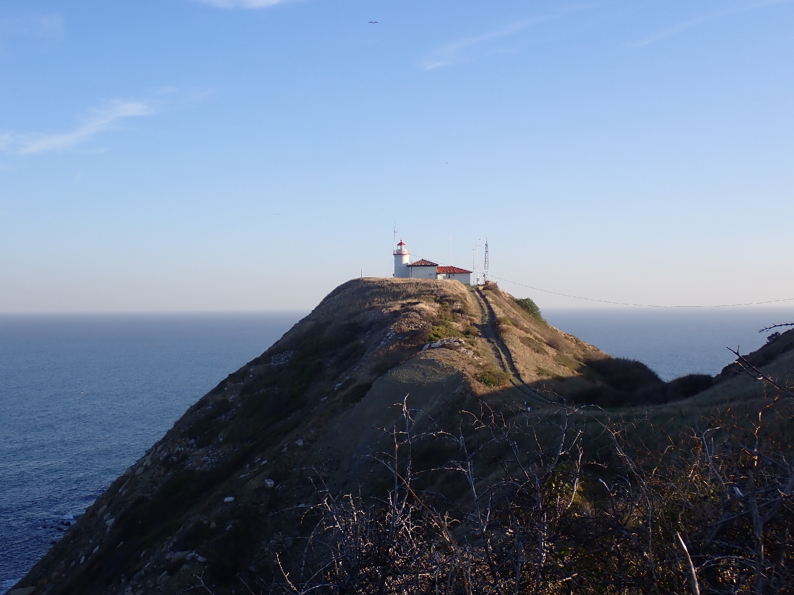
Cape Emine with lighthouse just about visible, behind is the Black Sea.

I was fortunate that I was not the only person eating at the Villa Emona. A lady with a baby and her friend kindly provided translation so that I could order some food for dinner. After a shopska salad (like a Greek salad) and a bean stew with sausages in, I had a dessert of Crème Caramel as one of the ladies said it was her favourite so she could recommend it. Then I felt guilty as along with her child we ate the last ones!

From the balcony of my room I looked out over the night. A few scattered lights indicated the boundaries of the small village, a few stars pricked the sky and on a nearby ridge there was a white, neon cross lit up. In walking to the Cape I had completed the first 2.1 kilometres of my 600 kilometre walk.

E3 in Western Slovakia: Some Comments

The E3 in Western Slovakia follows a series of ridges with many days involving total ascents of over a thousand metres. For this reason I fo...