Showing posts with label Serbia. Show all posts
Showing posts with label Serbia. Show all posts
Thursday, May 8, 2025
Comments on Serbia E4
I have commented on this part of the Serbian E4 before. The main difference on this trip is that gpx tracks of this part of the route are now available from Waymarkedtrails.org and are on Apps such OutdoorActive and Mapy.com. As I discovered this does not always mean they are walkable. Where there might once have been paths they may now be overgrown with thorny bushes stopping progress. To stay open tracks require farmers, forestry workers or hunters using them. Due to such issues walking the E4 in Serbia requires greater perseverance and mental fortitude than on many other trails, however the rewards are there as I hope you can see from my blog.


Kaldovo to Djerdap Dam: Day 55
An awkward border crossing.
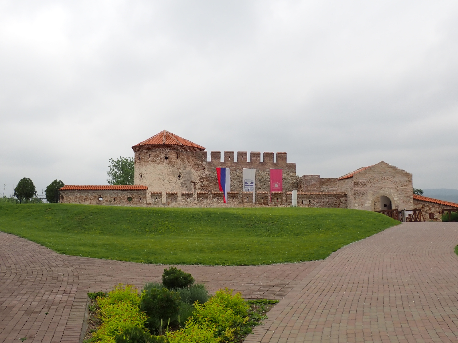
After breakfast overlooking the Danube I packed up and started up the road towards the Djerdap Dam. Heavy rain and thunder was forecast for the afternoon so I decided to aim for a hotel just after the Djerdap Dam rather than wild camp in the Romanian hills as I had planned. Consequently it was a short walk, so with plenty of time I visited the Fetislam Fortress just north of Kaldovo. Built by the Ottoman Turks there were earth banks and stone walls enclosing a large area of grass, and an inner castle with the ruins of towers, in which a stage and seating had been installed for summer events. It had all been recently restored and had a visitor centre where I bought my ticket and viewed the displays, which included mannequins in the dress of older times. I find it strange that the Ottomans were not expelled from the fortress until as late as 1867.
I then took a detour off the main road as indicated on maps showing the E4. While this avoided a stretch of busy traffic and visited fields of wheat edged with wild flowers, it also went by two areas where rubbish was dumped in large quantities. Not so pretty. The next diversion through the village of Kladusnica was more pleasant, especially as there was a shop for a mid-morning Coke and Kitkat and views of the Danube. I also passed the Roman Diana Fortress, of which the brick walls remain. As it did not look too welcoming I carried on.
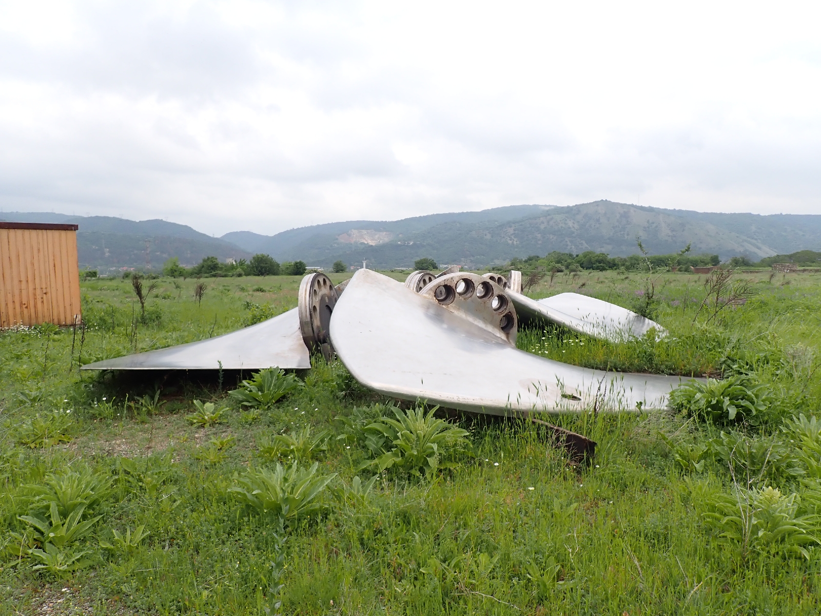
I planned to cross the Djerdap or Iron Gates Dam to get from Serbia to Romania, but there was a problem. At the Serbian side I was told I could not walk across the Dam. Not entirely unexpected as I had read of one blogger having a similar problem. There was little traffic crossing the border so when a Romanian minibus carrying workman arrived I flagged it down in front of the Serbian border booths. Although they had no English and I had no Romanian I managed to convey the impression I needed a lift. Initially the driver was reluctant, then a lady border guard told them they should take me, or at least that was the effect of the conversation. So I jumped in and soon crossed the Dam. The border guard on the Romanian side was more suspicious asking if I was sure I had nothing to declare, I said I was sure in a convincing tone and we were let through. The van dropped me off just outside the border post, they offered to take me further but there was no need. Noticing a sign saying Museum, or something similar, and being early for my check in at the hotel, I paid it a visit. There were a couple of tour groups of young people who I manoeuvred around to view the displays, some of which had English translations. They covered the history of the area with cabinets of broken pots and daggers. One area focused on the island of Ada Kaleh which was flooded as a result of the Dam being built. It was a Turkish enclave but despite being fortified by the Austrians, it remained the property of a Turkish sultan until 1923 when it became Romanian, before disappearing under the water. In addition to stuffed birds there was a model of the workings of the Dam. Built to provide hydroelectric power and finished in 1972 the shafts of the 12 turbines are vertical with the wide generator located above.
 |
| Djerdap or Iron Gates Dam |
Leaving the museum, passing the no photographs signs I started down the road to my hotel. I did not get far before I was accosted by a policeman standing by a cabin. Not sure what he was saying but I offered him my passport, showed him the ticket I had bought for the museum and waved in the direction of my hotel, saying "Hotel". It seemed to work, he said "ten kilometres" in English, and half a kilometre later I was in the reception of a rather empty hotel. The restaurant is closed but I have some supplies with me as otherwise it is a good half hours walk to anywhere to eat.
The rain and thunder has now started so I am glad I missed, and feel vindicated that I chose to stop at this hotel. Unfortunately it means a long day tomorrow.
Wednesday, May 7, 2025
Rest day at Kladovo: Day 54
A restful day, reviewing and planning.
Today I surveyed the damage received by my body from my walk. Blisters on the outside of the heal on both feet were the most painful. My left knee showed some fluid build up, although did not stop my knee bending. I used my knee support today to persuade the fluid to go away. Reddish insect bites dotted my body. There was also a general lack of flexibility as I tried to complete my morning exercises, exercises that I had not been able to do recently as I have been wild camping. I am in awe of what I completed seven years ago on the same trail, covering greater distances each day, having to divert due to lack of published information on the route. I would rather not believe it, but age is taking its toll.
Breakfast was in the hotel's restaurant overlooking the Danube, its surface calm and viscous, cranes stood sentinel on the opposite, Romanian shore. Later I did a little shopping and bought some lunch. This afternoon I booked places for the next few days. As the weather forecast for tomorrow is rain and thunder I changed my plan from wild camping to a shorter walk, just crossing into Romania before staying at a hotel.
A fancied a beer, so tonight I had one with a pizza on a pedestrianised street in town where there are a lot of cafés with chairs and tables across the road.


Tuesday, May 6, 2025
Grabovica to Kladovo: Day 53
A tiring day with an unexpectedly overgrown track.
As I settled down to sleep last night a thunderstorm started. Periodically lightening illuminated the canvas of my tent. Rain fell and I began to wish I had pitched the tent a little higher up, an irrational thought as it would take more than an hour or so of rain to raise the Danube by a few feet. Walking by the Danube for a kilometre or so this morning brought me to the village of Ljubicevac. All was quiet and the shop I remembered was no longer there. On the walls of the houses there were often granite plaques remembering someone who died complete with pictures. From the village the E4 took a track across rough ground. Initially the route was good but it became so overgrown with long grass, brambles and other plants the track entirely disappeared. As I had walked this way seven years ago with recalling any problems this was unexpected. I suppose when a path is unused nature soon overwhelms it.
I eventually fought my way through, the track reappearing as I approached the next village of Velesnica. As I noted last time none of the villages I went through today had an open shop, cafe or bar. In Velesnica I noticed a number of houses had oak branches draped over their gates, although not sure why. The village also had traffic cops stopping cars.
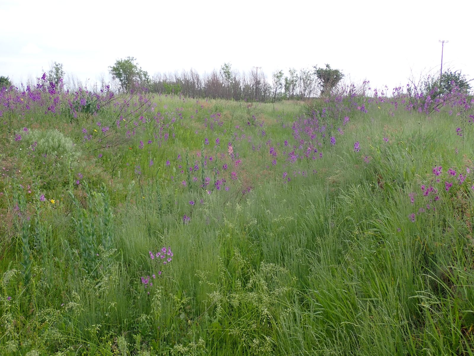
There was a junction where the Eurovelo 6 sign said Kaldovo 10 kilometres in one direction foĺlowing the main road and 30 kilometres in the other. Although 10 kilometres looked tempting the fast traffic on the main road was not. I took the longer route but not for 30 kilometres, that was for cyclists. After two more villages I turned off the road and followed a track up to a plateau. The route would cut off a meander of the Danube but I was worried about its condition following my earlier experience. Fortunately most was fine as it weaved through wheat fields, daisies (actually chamomile) and blue cornflours gracing the edges. There was one short section in the middle where I had to push through thorny bushes and the final downhill section through forest was muddy and slippery. I was relieved that there was no obstacle I could not overcome as the alternative was a very long walk.

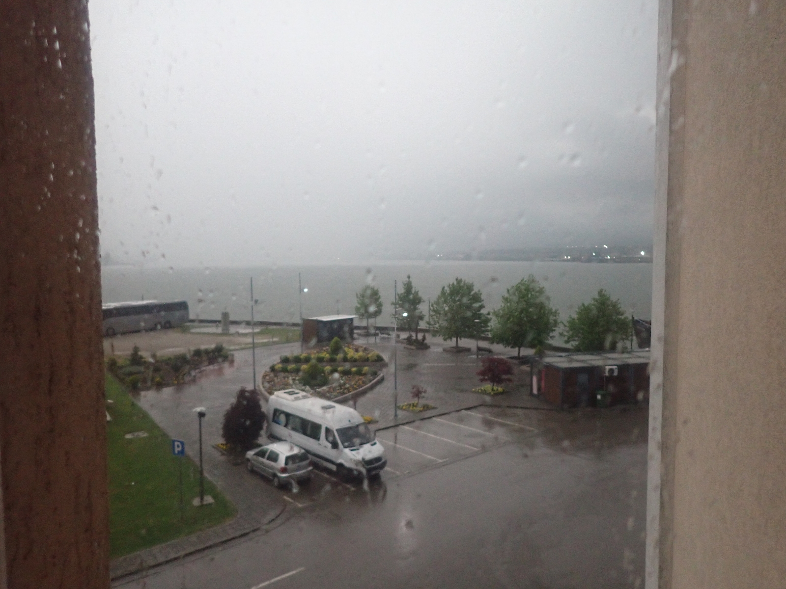
Back on the Danube flood plain, I followed a reed filled drainage channel for a while then headed into Kladovo. The E4 goes out to the Roman remains of Trajan's bridge but I had seen the brick pier before and was tired and footsore, so skipped this section. Kaldovo's suburbs looked prosperous as I walked through them. I watched mothers pick up their children from school as I ate a flaky creation from a bakery with a drinking yoghurt. Soon I was in the comfort of my hotel. It is fortunate I am not camping tonight as there is a major thunderstorm with heavy rain.
Monday, May 5, 2025
Vratna to Grabovica: Day 52
Today a walk into and out of valleys to reach the River Danube.
As on the last few days, I crossed hilly, high ground cut by deep wooded valleys which I had to descend into then climb out of on the other side. Yesterday it was the valley of the Vratna, today that of the Valja Mare, an unnamed brook and the Blederija. My day began with a walk on a gravel road beside the River Valja Mare. This involved crossing the river at fords a few times on the pebbly river bed. Nothing too deep but I changed into my "hotel" shoes to save my boots and socks getting wet, as they take a long time to dry. As was becoming familiar the terrain consisted of woodland, typically oak, grassland with long grass that seemed little grazed, and scrub land with hawthorn, wild rose and similar bushes. There was one area with an active farm. It had chickens, ploughed land, tractors and a stock of last year's maize. Wild flowers brightened my way; yellow, blue, purple and white. White May blossom released a heady, slightly pissy smell. Tortoises withdrew their heads into their shells when I tried to photograph them, although I came upon one tortoise chasing another at, for a tortoise, considerable speed. When the one in front stopped, the one behind knocked its shell making it continue moving. A male chasing a female I thought. If so, she was not interested.


The climb out of the first valley started well and then the path disappeared. Fortunately I was able to follow the route over rough grass. Then, after a long period of reasonable tracks I had to drop down a steep valley to an unnamed brook and climb the other side. At the top, a little before the valley, the track had disappeared among long grass, flowers and bushes. I was able to follow the route on my GPS, and once under trees, the ground cover suppressed, I found a good track. Rock had been excavated to make the track, so once it was important. Now no-one used it. At the base of the valley the vegetation was dense and I had to push through brambles to get to a path up the other side. The Serbian E4 certainly needs mental fortitude to keep going despite these difficulties. The final descent, on a track, deeply eroded by water, was to the Blederija waterfall. A pretty drop of water which deposits tufa (calcium carbonate) lower down. It was spoilt by all the rubbish at the picnic tables at the bottom. Two men were there who asked me to take their photo with falls in the background, in return they took mine.

I made good time on the road from the waterfalls to Brza Palanka, a village on the banks of the Danube, although the aggressive barking of the many dogs at settlements I passed was pissing me off. Why do people need so many noisy dogs? Why do they not like me? At Brza Palanka I stopped at a restaurant I knew for an early tea. Fish Chowder and Shopsa Salad with bread, followed by coffee and later a dessert of chocolate from a petrol station. There was a campsite by the restaurant but the toilets had bad reviews and I wanted to complete a few more kilometres so that I had a sensible distance to cover tomorrow. The E4 route continued on the banks of the Danube, and after walking along the embankment for a few miles I picked a spot to camp. Clearly used for fishing like all the obvious camping spots, so I am hoping no-one wants to do any night fishing here tonight.

As I write this a nightingale is serenading me, there is a cuckoo in the distance and I have disturbed a few squawking pheasants today. Skylarks sang in the sky overhead earlier in the day.
Sunday, May 4, 2025
Plavna to Vratna : Day 51
Main sights of today were Vratna Monastery and the natural arches behind it.
In the night I heard the sound of some animal coming up the track, then it stopped, evidently spotted my tent, and retreated, rushing off at speed. Leaving my cosy sleeping bag this morning I continued on the track I had used yesterday to climb out of the gorge. As I hoped it soon intersected the route of the E4. Many kilometres of track followed through woods, scrub and grassland. Quite a few tortoises were sharing the trail with me, although they quickly tucked their heads into their shells if I came close enough to photograph them.


At one location Waymarkedtrails.org and two mapping Apps showed the E4 turning left off the track I was following. My map also showed a gravel road in the indicated direction but there was nothing, only long grass and bushes where it should have been. I walked around where the track had been marked but found no trace of it. If there was one in the past it had fallen out of use a long, long time ago. It made me suspicious that the E4 route reported by a number of sources was based on out of date maps, but that no-one had actually walked the trail to check if the tracks still existed and were passable. Ignoring the Internet route of the E4 I followed the one I had walked seven years ago which was based on tracks seen on satellite pictures.
In time I turned onto a quiet tarmac road. There were a few cars, and also trucks, tractors and trailers loaded with logs, from their size I assumed for firewood, or maybe for turning into pellets for boilers (I later passed a factory making them). The old Zastava trucks, fully laden, strained to climb the hills in a low gear.
Jabakovic was a small town, more prosperous than I recalled. Probably because of poor weather last time, today was Sunday and the sun was out. Old age pensioners gathered in one building, ladies with head scarfs like my mother once wore carried their shopping home, older men were grouped around benches by the drinking fountain in friendly argument and there were a few market stalls selling fruit and vegetables, and sweet pastries. My small, strong coffee at the café by the market was served with fizzy water and a piece of Turkish Delight, just as I remembered last time, although the café had moved to larger premises next to the old one. Most of the men were drinking beer today and ordering hamburgers in flatbread. I wondered about asking for one but did not know the words and the waiter looked harried. It would probably have hung heavy on my stomach as I walked and I had only completed half my planned distance. Instead I bought a stick of fried dough from a market stall, like a doughnut but straight, not round. I ate it by the large war memorial.
Although a bit apprehensive I followed the E4 route I downloaded to Vratna gorge. Initially there were finger posts pointing the way, at least as far as a large group of charcoal burners, but the signs then disappeared. As I approached the small river, the E4 turned off the main track onto a "path" I could find no sign of. The forest floor was covered with an unblemished carpet of yellow flowers called Perfoliate Alexanders according to PlantNet. I accumulated a rash of yellow pollen spots on my trousers as I searched for the elusive path. Unable to find it I continued on the forest track I was on which, although overgrown, was easy to follow. It forded the Vratna river at a point where it looked deep but I could paddle across a little downstream.

Plenty of people were about at Vratna Monastery. I visited the church. Unlike at Bukovo yesterday all the frescos depicted stiff, solemn people in the traditional Orthodox style, there were scenes from the Bible, saints and angels. At the entrance to the compound a nun was selling monastery produce from a stall; wine, spirits and lavender products. I indulged instead in a coffee and ice cream (of the "Magnum" type but cheesecake flavour).

Suitably refreshed I viewed the first two of the natural limestone arches in the gorge behind the monastery, the third would have required a longer walk. The first arch was lost in the trees, but the second you could stand under and appreciate its size, the opening being 30 metres high according to a sign.

Leaving Vratna I was again following the E4 trail I downloaded. Last time I had trouble finding the route and was forced into a long road walk, but this time I had a gpx track alleged to be correct, it ran further west than I thought last time. The climb out of Vratna valley through oak woods was straightforward and led to a gravel road where there was a memorial to a fight between Serbian partizans and Chetniks in the Second World War. A little down the gravel road my route turned off onto a track. As it was well used I had some confidence it would lead me to and across the river that had caused me to divert onto the long road walk last time. My confidence took a hit when the track was blocked by a large pile of logs and cut branches. The well used track ended. After searching I found the continuation of my route, now a little overgrown. As forecast by my map the track thinned to a path, which was barely visible or not visible at all. I could detect from the flattened grass that someone had recently walked this way which gave me hope that I could avoid a long diversion. I progressed into woodland where the canopy had suppressed the undergrowth and the track reappeared, heading downhill into the valley, and I was soon in a meadow by the river, a rough gravel road down the valley in front of me. After checking the river was easily foldable I decided to make camp for the night having walked over 30 kilometres. Although the grass is long the ground is flat but flies have driven me inside my tent.
Saturday, May 3, 2025
Negotin to Plavna: Day 50
A full day with visits to a monastery, a Roman ruin and a natural tunnel.
I reluctantly left the "Base for Adventurers" after some jam filled pancakes and coffee from my hosts and Kefir that someone was trying to use up. The E4 does a circular tour of the countryside around Negotin before heading west. When I walked it before I did not think the circuit was justified by the scenery so decided on a more direct road route. This had the added advantage of passing the Bukovo Monastery a few miles out of town, on the steep slope just above where the flood plain of the Danube ends. A popular destination, the Orthodox monastery is of ancient foundation, maybe early 14th century, but the paintings in the church and on the iconostasis were more modern. They were not in the usual formal style of Orthodox churches, they had greater realism. On the ceiling, in addition to the usual images of saints and kings there were animals with wings such as a winged lion and bull.

I continued on the road. The E4 route from Waymarkedtrails.org deviated off to the north at one point and I walked up the track to investigate. However, the route turned into an overgrown track and the map indicated it would narrow to a trail with a river crossing. Today I did not feel like wasting time pushing through vegetation without any real reward so I returned to the road which I followed to the village of Jasenica. On the main road by the village there was a shop. As usual there were a few men sitting outside drinking bottles of the local beer. With their lined faces and grey or greying hair, sitting on the veranda on wooden benches, a scarred table between them, they looked like a painting by a modern version of Van Gogh. I joined them for a Coke and Twix.
After Jasenica I followed tracks in the direction of those on my GPS, but not quite on them. Maybe these tracks through woods, over grass and by fields change with time as a tractor driver decides to take another route. Then it was down the road to Šarkamen which has been resurfaced since I last walked it, when it was a pattern of pothole patches in varying shades of grey. Now it is smart tarmac, complete with white lines each side. The route from Waymarkedtrails.org again did an annoying diversion into the trees which I ignored.
Being hot I wanted to top up with water. After passing two older ladies in black, complete with headscarfs, sitting in shade in their gardens, I spotted an older, but more active man with a wheelbarrow. After the courtesy of a "Dober Dan", I questioned "Voda?", and waved my almost empty water bottle in the air. He led me to the side of his house where there was a tap. He ran it for a while until the water was cold then let me refill my water bottle.
As it turned out, his efforts were not essential, five kilometres later following a gravel road I was at the 4th century Roman ruins of Šarkamen. Under a shelter there was a tap, which I used for a further helping of water. There were also benches on which I enjoyed a late lunch. There were no people about and little information, a "Scan me" sign led to an inoperative website, however there were the remains of walls, towers, toilets (I thought as they were similar to ones I had seen at other Roman sites) and a mausoleum with a dome. Quite extensive but not well presented.

My next sight, another five kilometres up the road, was just off the E4 route. This was the Zamna Gorge. The route from the road was well signposted and maintained, but after an easy section through trees, the path rose and fell among rock outcrops before steeply dropping to the bottom of the gorge where I was faced with a river. A group of people were there. In answer to my query they told me the main sight was to the left, and to reach it without getting wet I had to walk on the boulders beside the cliff that made a precarious path beside the river. On arriving at a small beach, I could see that the river ran through a huge cave that it had created. Then I discovered the cave had openings both ends so was more correctly a natural tunnel. There was a gap in the roof and with time it looked like a natural arch would form. In investigating the tunnel I crossed the shallow river on stepping stones. I remember thinking I should have my trekking poles out for balance in case I slipped. Immediately after I slipped and soaked much of my trousers and tee shirt.


After viewing the main feature I followed signs in the other direction which were marked "information", crossing the river on stepping stones safely this time. There was no information, instead an empty wooden hut with a serving hatch arrangement and a large rubbish bin. It seemed unlikely that these had come down the narrow and rocky path that I had used. There was a wider track going up the side of the gorge in a northerly direction. To avoid retracting my steps I thought such a good path must lead to a road or track from which I could join the continuation of my E4 route. Following it would save a kilometre or so retracting my steps. Consequently I climbed the path, confirmed I could use it to regain my route and them decided it was time to find a spot to pitch my tent for the night. I am now pitched on an old track in the woods, slightly overgrown and evidently not used for a while. I hope it is not used tonight as I will be in the way.
Friday, May 2, 2025
Negotin rest day: Day 49
A busy day resting.
There are always numerous chores to do on a rest day. After a breakfast offered by the host (coffee, flaky pastry things, yoghurt) I put my clothes in the washing machine at the "Base for Adventurers". Then I went to buy a Serbian SIM card. Not having access to the Internet was causing me problems with booking accommodation, communicating to my wife etc.. My sister told me I should get a dual SIM phone, one SIM for the UK and one for Serbia. Later, checking the details of my phone I discovered it could take two SIM cards!
Buying a SIM card was the easy bit, making it work was a problem. First, putting it into the phone was difficult, but with the help of members of the accommodation's family we discovered I had to remove the SD card and put the SIM in sideways. Second, the SIM had to be registered. Not so easy but again help was provided with the Serbian on the website and App. Registration required taking a photo of my passport and comparing it with a selfie. We could not pass this stage. Finally I went to the Yettel shop, Yettel was the phone company. They did not sell SIM cards but did get me registered. There was an option somewhere to say it was a British passport that we had missed. So now I have 15 GB of Internet access (or maybe 5). The cost was modest but the effort required was large. I can understand why they want to prove who the phone user is, as part of the fight against crime, but I feel it could have been much easier.
Simpler tasks involved answering email, bringing my blog up to date, and shopping for food and batteries. Also a chance for a long conversation with my wife over WhatsApp without worrying about the rapidly rising cost of the international call. The "Base for Adventurers" was a great place to stay as it was a chance to talk with others doing similar activities helped by snacks provided by the host and beer, rakya and wine which appeared from somewhere. I was curious as to what one of the guests was doing on his laptop late into the night. He said he was working on an urgent tax return for a Ukrainian. Not so much "working from home" as "working while touring Europe on a bicycle".
Thursday, May 1, 2025
Rajac to Negotin: Day 48
An unexpected May day celebration, a tick and a welcome arrival at Negotin.
Overnight my feet throbbed with today's exercise and there were signs of fluid accumulation on my left knee. However, by staying at a house in the village I had the luxury of shaving off my designer stubble, grown over days of wild camping, completing my morning exercises, making a coffee and sitting on a toilet. Then it was off over the hill, to the village of Rogljevo, where there were also "pimnice" or wine cellars, as by Rajac.

This morning was mainly on tracks through woods, by vineyards and among scrub land. The vineyards were small, disconnected plots. I wondered if this was the amount of land originally owned by a single person. While some vineyards were well looked after, the earth between rows of vines neatly turned over, others seemed to have been abandoned. I spotted a number of tortoises today, somewhat camera shy.

I noticed a black spot on the inside of my right elbow and tried to scrap it off, thinking it dirt or an old scab. When it did not come off I wondered if it was a small or nymph tick. From the bottom of my rucksack I pulled out my packet of green tick removal hooks. Our vet used one to remove a tick from our dog and I was impressed how well they worked. Unfortunately even the smallest green hook was unable to grip the tiny insect. It did however loosen it so I could get it off with my fingers. Now looking at it closely I could see at least two front legs, definitely an insect so I immediately dropped it, then worried it had got mixed up with the stuff I had just pulled from my rucksack.

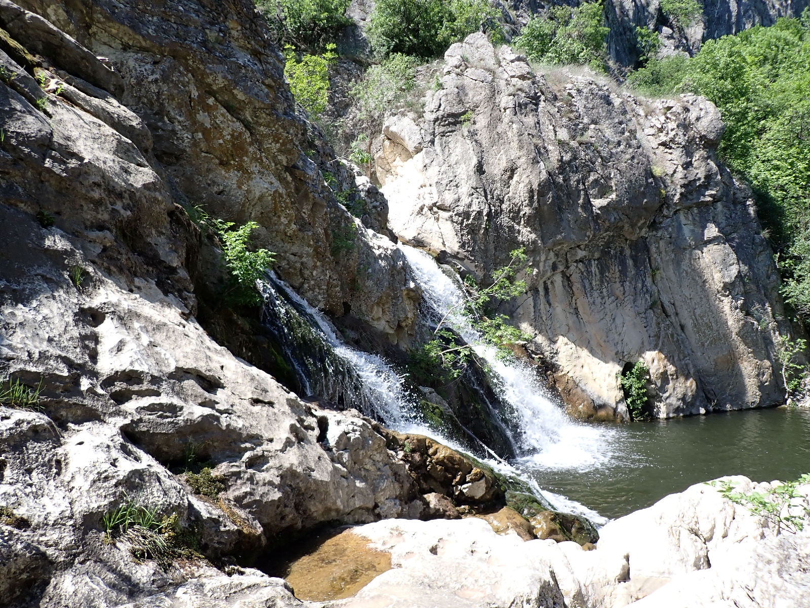
My woodland walk ended at the Mokranje waterfall, where two streams of water fall over grey limestone from a narrow valley into a pool beneath. Today was the May 1, Labour Day, so no-one was working as it was a public holiday, consequently several people were about at the falls and associated viewpoint.
At the nearby village of Mokranje a May Day party was in progress. I was invited to join a table and offered cold pork, cucumber salad and a bread roll. Declining a beer I accepted what I thought was lemonade. Only latter after I had drunk a fair amount, the day being hot, did I discover that it was half lemonade, half wine. A band was playing; guitar, keyboard, drums and accordion, fast, "gypsy" style music. The people who invited me (one of whom was a Doctor of Urology) told me they were singing in Romanian, which they did not understand, however there were a few slower songs in Serbian. One they said must be my song, a sad song, because the singer's love for a lady was not returned he goes walking around the world.

I eventually took my leave, thanked them after they refused a contribution to costs, and headed for Negotin. For the next section the E4 makes a long detour to a point where Serbia, Bulgaria and Romania meet in the Danube. Having visited it before, and since I was only on the E4 due to a gap in the E3, I decided to just take the quickest route to Negotin where I was looking forward to a rest day. So I began a nine kilometre walk along the road up over the valley side. The wine and lemonade dulled the pain in my feet but made the walk hard going, as I felt like lying down rather than walking.
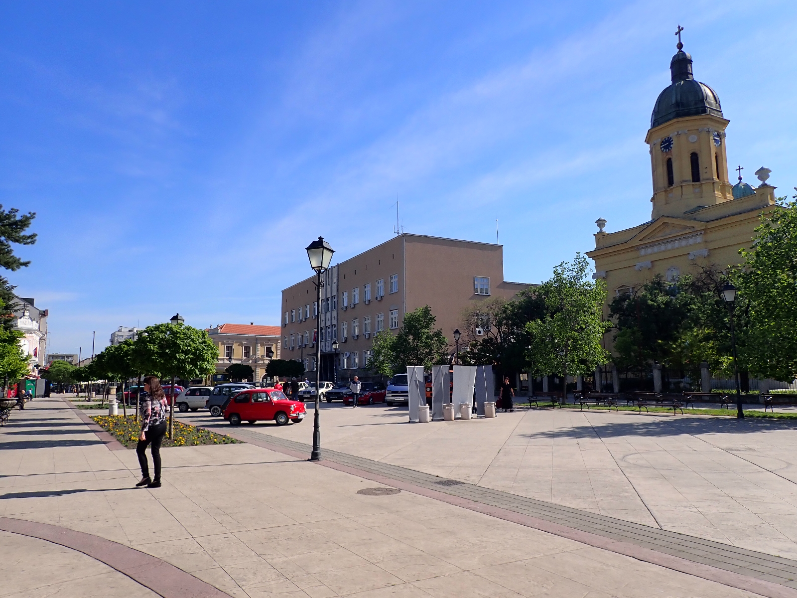
Step by step I finally arrived at Negotin, a good sized town with a smart central square. Last night I had rung to try and get a bed for two nights at the "Basecamp for Adventurers" where I had previously stayed. Although busy they managed to find room for me, without me having to erect my tent on the decking in the garden (screws provided to replace pegs). I spent the evening sitting around outside with the other guests. An international group from Serbia, Britain, Austria and Estonia. Debs and Tom from the UK were particularly interesting being on a four year cycle trip around various parts of the world, including cycling through remote parts of South America and falling ill many hours drive from anywhere. The owners joined us providing numerous snacks and I might have drunk a bit more wine...
Wednesday, April 30, 2025
Sikole to Rajac: Day 47
Much of today's walking was on roads on painful feet, but I was found a welcome bed and shower at the end of the day thanks to the helpful owners of a Bed & Breakfast.
Leaving my camping spot and continuing on the track I was surprised I was so close to a gravel works. Not that it was operating while I was camping. On the trackside I admired drifts of small purple flowers on tall stems. After the mountains of my trek so far, today was flatter, the topography gently flexing to give long inclines and declines. Much of today was on roads, quiet ones except for one busier highway with fast cars and trucks. I stayed on this longer than expected as the E4 track from the Internet crossed a deep ditch with overgrown sides. Instead of risking scratches at best, I took a road route which was only slightly longer. My surroundings included farmland with recently ploughed fields, hawthorn scrub which was probably abandoned farmland, and oak woods. The latter were especially pleasing as the sun shone through the new green leaves. A buzzard or similar circled in the sky.


I deviated into the village of Klenovac to see if they had a shop (they didn't) or a bin to put my accumulated rubbish. I could not find any. Other people had resorted to fly tipping, dumping piles of waste of all kinds beside the track I followed out of the village. At the next village of Tamnich I found a wire bin to place my rubbish in, although I wondered if it was ever emptied. The earth around the bench where I had stopped for a few minutes was embedded with beer bottle tops, a favourite place for local drinkers it would appear.
I continued on to the village of Rajac, a railway line beside me for a while. My feet were suffering. On each step the pain moved from my heel to my sole to my toes as I hobbled along, as if I was walking on a bed of nails. On uneven ground, when the sides of my soles contacted the ground there was an additional source of pain. Consequently, although I hoped to complete a few more miles I gave into my weakness and asked at a Bed & Breakfast (Villa Milenovic) where I stayed before if they had a room. Although they were full, a party from Slovenia was due soon, they gave me a cup of coffee and arranged for me to stay at a house rented by another couple. The couple had developed a new winery in the village, she was Serbian and he was English, or maybe Irish. Their business ventures must be bringing new life to the village that would otherwise decline like many others as people move away for work. The house I am staying in is rustic: brick floors, old furniture, old photos and mirrors with wonky reflections. Attached to the building was a wooden enclosure, maybe once a barn. When I arrived I was amused to see a lady strimming the lawn while a man stood by. Typical! They then both sat down for a can of beer each.
The really nice, helpful couple at Vila Milenovic also booked me dinner at an Ethno Restaurant. However I soon realised it was at Rajačke Pimnice, about a kilometre uphill from where I was staying, not ideal after a long day walking. Nevertheless, I wanted to visit the place and doing so this evening will save time tomorrow. Pimnice are buildings where wine is stored, and probably fermented as well. There are many of them grouped together up the hill from Rajac. A fair number are now abandoned which implies there was a much larger wine industry in the past in the area. The pimnice are characterised by entrances with a simple, semi-circular arch. An architectural feature I began to see in Sithole yesterday.

I mentioned them in the blog of my previous trip and a comment was made that there was also an ancient cemetery by the pimnices. I went looking and found a mixture of new and clearly much older gravestones. The modern ones have pictures of those who died, a local practice. The old ones in sandstone have crosses and symbols carved in them, some looking like suns. They have little or no writing on. My landlady told me they were not necessarily Vlach (an ethnic group in the area) as I had been told, and that little research had been completed. She said they were applying for UNESCO listed status, which would certainly increase visitor numbers. The European Union has contributed to upgrading the paths and lighting.

I was not sure what to expect for my meal due to language difficulties. It started with cold pork, cheese, cucumber salad, hot chillies, bread with rakya and progressed to minced meat in cabbage leaves and something like Mexican refried beans with a glass of wine. A trio of small dry cakes ended the meal. Suffering today improved the enjoyment of both my meal and my bed tonight.
Tuesday, April 29, 2025
A hill after Krivelj to after Sikole: Day 46
Today's highlights were climbing Veliki Krs and reaching Sikole before its shop closed.
Veliki Krs was a distinctive ridge, its spine rising up from the east. Last time I was here I failed to climb it as I was unable to establish where the route down on the other side was. A disappointment. Now that Waymarkedtrails.org has published a route all is clear. The path is not where the guidebook, "Rambling in Serbia" implied. So this morning I climbed up a narrow path which took an oblique route up the south side of the ridge, starting from the eastern end. I was fortunate that in addition to occasional red and white waymarks, frequent fragments of faded caution tape had been tied around the branches of low trees and bushes. Where I missed one on a small, stony area lacking bushes, I was soon struggling, faced with impenetrable bushes of lilac and, even worse, thorny hawthorn. Forced to retrace my steps I eventually spotted a faded strip of plastic in a place where there did not appear to be a path until you were really close. Just coming into pale purple bloom the lilac looked wrong growing on a Serbian mountainside rather than in an urban English garden. When I stepped on more rocky ground, the herbs between the stones released a fragment smell, reminding me of the scented packets of herbs sold for ladies pillows.

The E4 does not go to the summit of Veliki Krs and nor did I. On the crest of the ridge I sat and ate a late breakfast while admiring the views of mountains I had crossed and those yet to come. To the east there was extensive open cast mining and smelting for copper, around the town of Bor. Considerable care was needed to descend the steep north side of the ridge where in places the path headed straight down. If the earth had been wetter I would certainly have slipped, bruising my bottom on the many rocks. Tree roots acted as steps in places, or else tried to trip me. Eventually the gradient of the path became a little less, although not by much, and I was relieved to reach the valley bottom.

However I had two more ridges to cross. Neither as challenging as Veliki Krs but on the second ridge, the cliffs of the mountain of Stol rose dramatically to my right as I crossed at a wide pass.

For the remainder of my day I alternated between farmland and low trees as I made slow but steady progress. The sun and blue skies were very welcome, finally drying out my boots. However the heat made me worry about water supplies in the dry limestone landscape. I was drinking heavily without peeing so dehydration was a concern. My plan was to collect more water at the village of Sikole, but had nothing to confirm a drinking fountain or an open shop existed there. My route moved off limestone into an area of coarsely crystalline rock, its black crystals glinting in the sun where the rock was broken and used to reinforce the track. Evidently impermeable soon after there were a number of streams crossing the track. I collected two litres of stream water in my plastic bladder from one of these and added a couple of water purification tablets as I was unsure of its quality. As it transpired I found a shop at Sikole and bought three litres of mineral water which I used instead of the stream water which tasted of chorine from the added tablets. I sat outside the shop and enjoyed a Coke, crisps (feeling in need of salt) and chocolate, watching a succession of old, red tractors return home for the evening.
A few kilometres after the village, having completed 30 kilometres, with my knee and heels complaining I picked a spot for my tent among scrubland that no-one appears to care about judging by the fly tipping. I avoided the areas desecrated by dumped rubbish and found a good, flat spot among a cluster of trees, an improvement on recent pitches. There is a building in the distance, but it looks abandoned.
Monday, April 28, 2025
Woods before Borsko Jezero to a hill after Krivelj: Day 45
Highlights today were refreshments at Borsko Jezero and Krivelj!
After struggling to decamp on the slippery slope avoiding tree branches, my next challenge of the day was to climb over Tilva Njagra. Mature oak and beech covered this hill, obscuring any view, although they were pleasant in a green sort of way. On the other side of the hill was Borsko Jezero, a reservoir fringed by trees and walkways. There was a hotel (where I might have stayed if I had managed to walk further in the last two days), holiday homes and at least two cafés, both closed. The place looked more run down than I remembered although people were out cutting the grass and keeping it tidy. Near the end of the town I found a campsite, mainly static caravans and huts, which had a shop where I indulged in a Coke and ice cream.
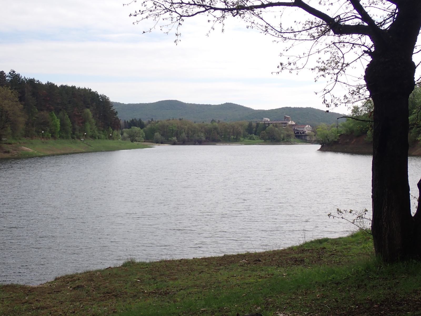
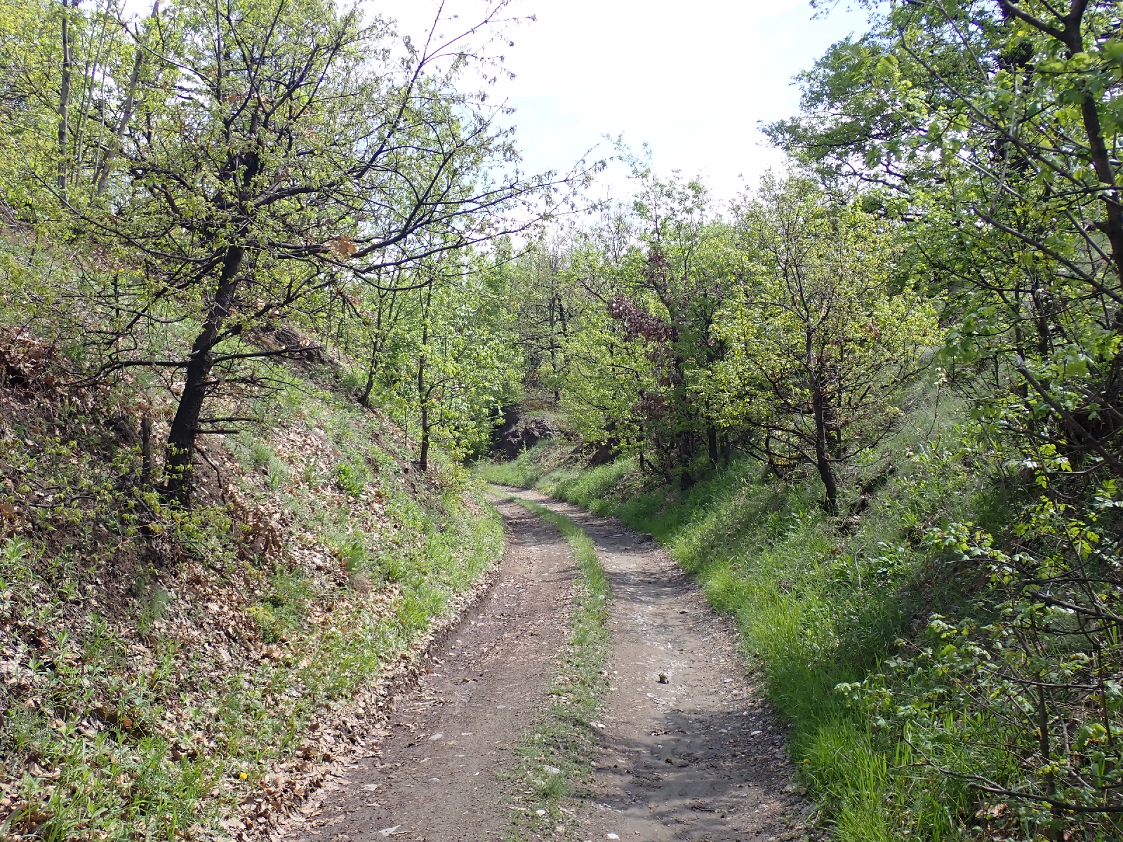
There followed a complex route, around the lake, up a hill, along the bed of an old railway line, down roads and across fields. One section, using the route from Waymarkedtrails.org rather the one I walked before, ended at a farm. An older man, missing a few teeth, was picking dandelion flowers. Despite language issues he established I was headed for Krivelj and led me through his outbuildings, upsetting the dogs who barked loudly, and pointed out the right track. On learning I was walking to Krivelj he asked "why". I could not think of an answer so just shrugged my shoulders.
On reaching Krivelj some hours later, I concluded it was time for another Coke and chocolate. The shop keeper spoke good English. I remembered him from my last visit, although he had moved across the road to a larger, but still small shop. He topped up my water bottle for me before I climbed the road out of Krivelj. I then had a dilemma. Facing me was the mountain of Veliki Krs, the next milestone on my route. Rising steeply to 1060 metres I could conclude from the tightly spaced contours on my GPS map that there was not going to be a flat spot suitable for camping once I started climbing. Lacking time and energy to reach the top and descend the other side, which was even steeper, I decided to camp early after 29 kilometres of walking. A nettle filled valley among woods seemed the best place to camp. At least it was flat and there was a stream for washing. After trampling down a lot of nettles I erected my tent. It is a bit lopsided as the ground is uneven but it will do for the night.
Sunday, April 27, 2025
Bogovina to a wood before Borsko Jezero: Day 44
Although little rain today it was a wet day nevertheless to see the Lazarev Canyon.
From the heavy rain last night my tee shirt, underpants, trousers and socks were all wet. Yesterday I squeezed as much water out of them as I could but they were still soaked this morning. I had hoped for a sunny day to help dry my clothes but the morning sky was grey and overcast and remained so all day. A little light drizzle was falling during the morning. Wanting to preserve some dry clothes I had no alternative but to put on my cold, wet underwear, socks and trousers. I left my tee shirt in my bag until later and put on my fleece, which I had not been wearing in the rain yesterday, so at least I had something dry and warm on around my "core". Then I added my "waterproof" jacket, wet but not holding the water which slid off in drops. I headed off, the wet vegetation making my trousers wetter still. Diverting off the route slightly I went to the shop at Podgorac which I had visited on my last trip. I had not expected it to be open being Sunday but three men were drinking beer outside the wooden shack that housed the shop. I went in and bought a can of cold latte, chocolate and water. Although not essential purchases, it gave me a morale boost as I felt more in control, and chocolate was a treat. Then I followed the E4 route to the mountain of Veliki Malinik. A long, steady, uphill walk on a good track through trees. There were a few fire salamanders on the track, sluggish with the cold, they would only move away slowly if I approached.

Near the top three 4 x 4 vehicles were parked with men standing outside, noticeable as I saw few if any people away from towns and villages. Maybe a hunting trip. I did not approach as the E4 went around the summit of Veliki Malinik to the south. Following the ridge east I stopped by a picnic table to see the Lazarev Canyon from above. The weather was not ideal to view this long, deep, irregular gash through the green landscape, the ragged cut exposing cliffs of the grey limestone, beneath the thin skin of vegetation. The thin path down to the second viewpoint was more difficult and tortuous than I recalled, overgrown, with fallen trees to negotiate. The lower outlook was more popular. There was a group standing on the rocks above the tall, vertical cliff on the edge of the gorge, listening to a guide.


Nearby a crude building housed a place selling food and drink. A new facility where I bought a late lunch of meat, potato and carrot stew served with cabbage salad and bread. Dessert was two pastries similar to scones with the jam baked inside. Replete, as I left a group on ATVs (All Terrain Vehicles) roared down the track. From the outlook it was a good track and path down to the bottom of the valley. There is a show cave at the end of the canyon but it was closed.
Roads and tracks through farmland took me north. The telegraph poles were intriguing, made of irregular tree trunks they looked very flimsy. I had hoped to reach Borsko Jezero, a reservoir and tourist resort, but I was not going to make it tonight, so around 6 pm after walking 11 hours, I turned off into woods to find a spot to camp. A flat spot was difficult to find so I made do with a small patch, less sloping than the rest. There was no phone signal so I used my satellite communicator, new this trip, to send a message to my wife confirming I was OK.
Saturday, April 26, 2025
Rtanj to Bogovina: Day 43
Two challenges today, first I was blocked by an unpassable path, second, I was drenched by torrential rain.
 |
| Lilac growing beside the track |
After a substantial breakfast with spirals of flaky, cheesy pastry I set off to follow the published E4 route on waymarkedtrails.org and various Apps. This crossed a tree covered ridge. Initially progress was good but degenerated. Much of the track had been turned into a ditch filled with last year's leaves, the result of erosion by water. Fallen trees made additional obstacles. Then the route took a "path" to the left. Clearly no-one had used this route for many years as it was overgrown and progress was difficult. If there had been a hundred metres to push through I would have found a way around, but there was over a kilometre to what the map claimed was a bigger track. In addition, the maps indicated that there was no path or track at all later on. I decided to retreat and follow a route along roads and larger tracks to the town of Boljevac. This deviation took me to the west of the ridge, through a quarry and the village of Mirovo. At Boljevac I stopped for a coffee and bought a pastry containing two types of cheese and ham for my lunch. After this small town, tracks and gravel roads took me north. I passed the domed kilns made of brick used to make charcoal.


This morning the sun had shone, but after lunch black clouds gathered. Thunder boomed and rippled around the hills and I could see the slanting gray streaks of rain falling in the distance. It seemed a pattern that thunder and rain was more likely in the later afternoon. I hoped the storm would stay away from me and initially it did, but then it changed its mind. Lightening began to strike near me, the loud crack of thunder closely following the white flash of the electrical discharge. On occasions I could see the lightening forks reaching the ground or crossing between clouds. I was glad to be among trees which might not give complete protection against lightening but was better than being exposed in the open. The rain, which started as a few spots, turned torrential transforming the track I was on into a muddy river. I took shelter for a while among trees, which provided little protection, nor did my waterproofs. Despite rain jacket and over-trousers my tee shirt and trousers were soon soaked and my underpants followed. Water filled my boots. I lost concentration on my navigation, missed a turn and had to retrace my steps. The air temperature was dropping fast and my wet clothes made me very cold. As there were clearings in the woods I decided to pitch early at 4:30 pm. Once out of the rain in my tent, I pulled off my wet clothes, wrung out as much water as I could, and snuggled into the dry warmth of my sleeping bag. The rain and thunder eventually stopped and the birds have begun to sing. A dog is barking and I can hear voices but doubt I will be disturbed on such a wet evening.
Friday, April 25, 2025
Sokobanya to Rtanj: Day 42
High point of the day was climbing to the top of Šiljak, the summit of the Rtanj mountain range.
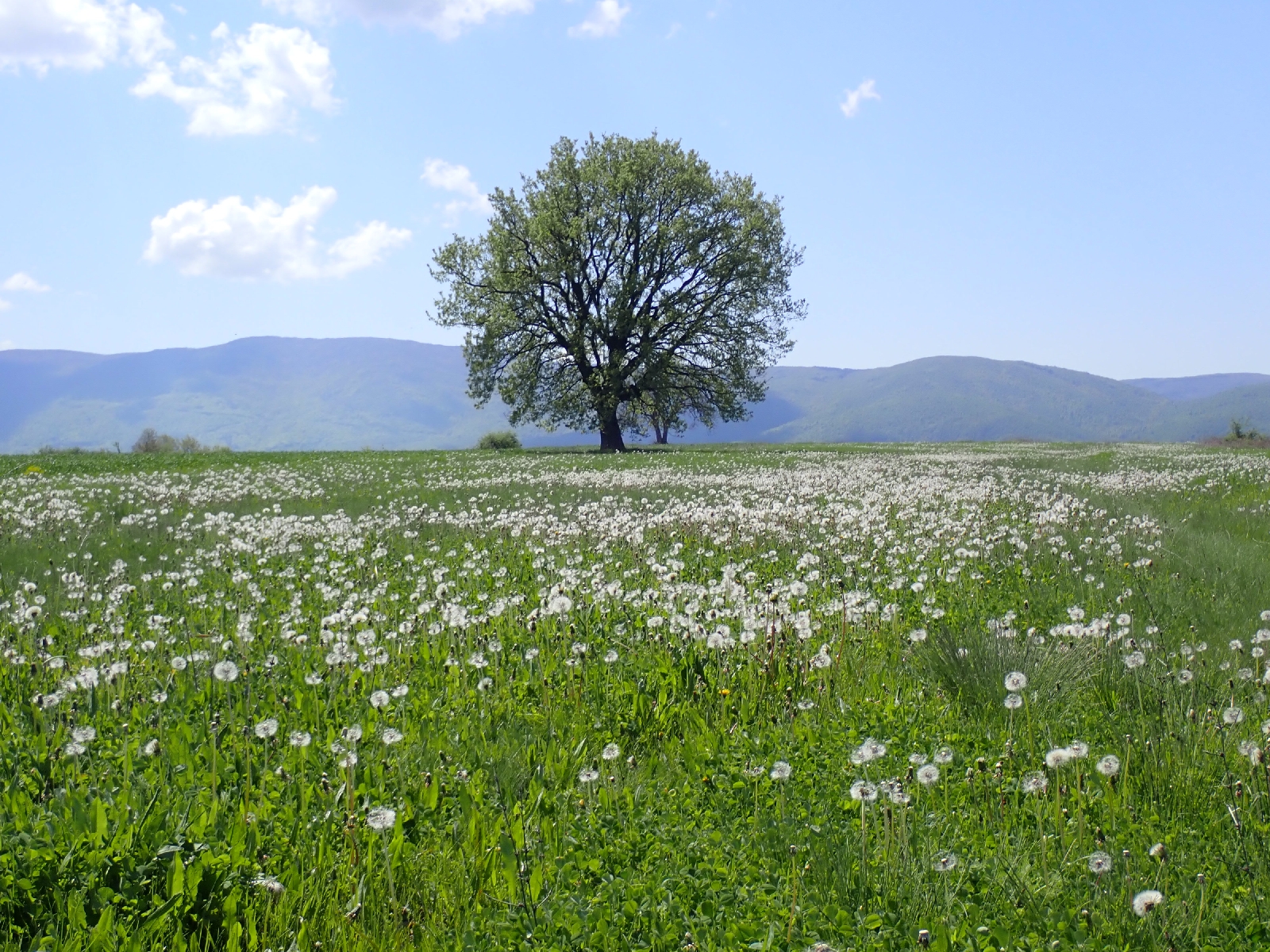 |
| A field of Dandelion clocks |
My route out of Sokobanja led to an overgrown track through low trees, where I had to push through thorny bushes. I slightly regretted not taking the route along roads I followed previously. However I withstood the challenge, finding my way and after a few kilometres the tracks became easier to walk along, running beside cultivated fields and grassland, moving in and out of trees. The pyramidal peak of Rtanj rose in front of me but first there was a ridge to cross climbing along barely visible paths.

Red and yellow waymarks indicating the E4 appeared a few kilometres out of Sokobanja giving me confidence I was picking the right tracks to follow. In a valley I passed a shepherd driving a dozen sheep across a meadow with his black dog. After crossing the ridge at a saddle the track led me down to a group of buildings. Music blared from a van but I could see no-one. A sign advertised a restaurant and camping but the surroundings made this seem improbable. A long, steep climb followed to the highest point of the range, a summit called Šiljak. My steps released an earthy, herby smell from the plants I crushed beneath me as I struggled up the mountain. On the lower slopes there were lilac bushes about to bloom. Higher up among the rocks, the bushes disappeared. There were plenty of flowers, some I recognised; cowslips and grape hyacinths, and many others I did not. Due to their variety and profusion it is a Special Nature Reserve. Some believe that, with its pyramidal shape, the mountain is a source of "special energy". After reaching the ridge a path led around outcrops before zigzagging up to the top at 1565 metres high, where there were the ruins of a chapel. In the middle of the stones there was an Orthodox style cross with bangles and other items at its base.

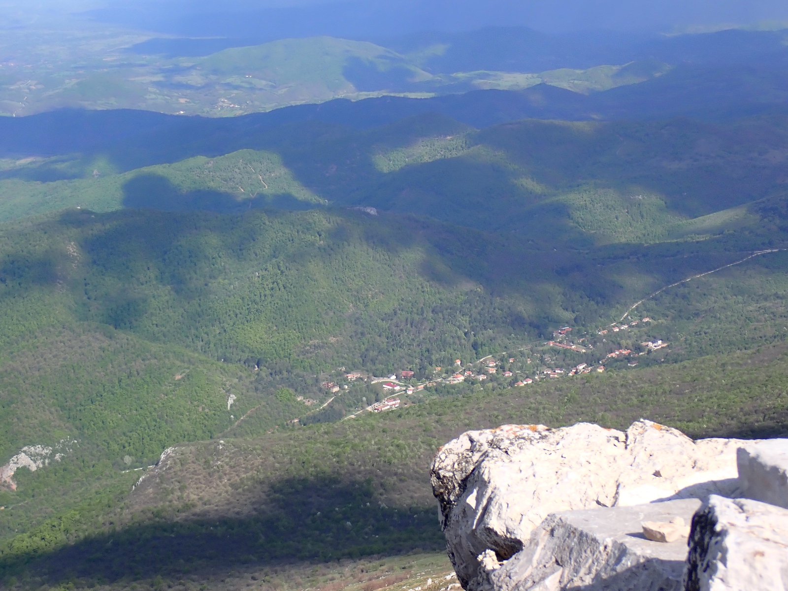
I reached the peak latter than expected so had to hurry down to the village of Rtanj, followed by a dog. Fortunately not a stray dog, it was obviously well cared for, its long fur was not matted. He left me at a cabin. Near the bottom a lad, who had walked down the mountain ahead of me, asked for some water, but like him I had run out, the tiring climbing in hot weather making me more thirsty than normal, and there were no springs in the dry limestone landscape today.
Rtanj village looked more prosperous than I remembered when I passed through last time. People were walking around, mowing lawns and selling herbs and honey at roadside stalls. At Pansion Radgost a lot of people were about. A party of neighbours and friends were getting together for a meal. The lady organising the group also organised me as the staff were busy in the kitchen or mowing the grass. Not only did I have chicken and mashed potatoes for dinner, but the group on the large table also gave me cold pork, and a portion of salad. Typical Serbian food I was told, Serbian hospitality for sure.
Wednesday, April 23, 2025
Rest day in Sokobanja: Day 41
A day completing chores and resting my legs.
I was fortunate that today was a rest day as heavy rain fell and thunder echoed around the hills behind the town. The day passed quickly, washing clothes, shopping for supplies, answering emails, catching up on my blog. As B&B Nataly had a Spa, I visited the pool, which although too short for proper swimming at least gave me the opportunity to exercise muscles different from those used for walking. I did of course manage a coffee and chocolate orange cake. I looked for a shop to buy a local SIM card to allow Internet access without the need to find WiFi, but the town appears too small to support a phone shop. Looks like I will be on Internet "Detox" on my days camping.

A hill after Beli Potok to Sokobanja: Day 40
A day crossing flower filled, limestone grassland and tree covered hills ending at the tourist town of Sokobanja.
Over night I heard animals stepping around my tent and munching. I had heard a stag bark earlier so assume they were deer. I left them in peace and they did the same for me. I left my pitch at 8am and followed the route I downloaded from the Internet for the E4. Differing from the one I took seven years ago it led along winding paths through the woods to the north, whereas I had followed more open land to the south. Yellow and red stripes and circles appeared on trees soon after my camping spot. These were the Serbian waymarks for the E4 and joined the red and white markings used for local paths, both new since my last visit. I liked the open spaces, the limestone rock peeping through the soil, surrounded by yellow and blue flowers. Further away mountain ranges spread across the horizon. White clouds filled one of the valleys below me. A cuckoo sounded.

In the woods I was glad of the red and yellow stripes that led me on a circuitous path, overgrown in places. Amongst the trees I passed a well, enclosed within a tiled red roof and wooden trellis, but who collected water here, there was no sign of any building nearby? Finally, the route reached the highest point on the range I was following, Čaplijnac at 1187 metres. I balanced on the rocks at the top to take of photo of distant mountains before descending down into meadows. There was then a final challenge, a climb up to the steep sided peak of Ostra Chuka. A couple were on top, taking pictures, the first people I had seen today. A sign I was leaving the remote area I had been crossing for the last two days and joining tourist trails around Sokobanja.

A long descent ensued as the path rapidly shed height. Not easy on my knees. The latter parts were of more mature forest with some tall beech, rather than the hawthorns I had been walking among this morning.

At Sokobanja I entered a town quite different from the places I had visited so far on this trip. A well kept, tourist town with families walking along the pedestrianised main street, the smaller children either insisting their parents carry them, or wanting an ice cream. After a coffee and cake I found my hotel and settled in. Then I wasted a lot of money phoning my wife on the mobile network rather than using WhatsApp on the hotel's WiFi. I guess I was tired, due for the rest day I have planned for tomorrow.
I am now sitting at a restaurant, outside beside the main drag people watching, stuffed after eating too much.
Subscribe to:
Posts (Atom)
Prague and return home: Day 184 &5
An informative day spent seeing Prague, followed by my return home. I joined a walking tour of Prague this morning (feeling that...

-
The Kom-Emine trail is a 600 kilometre long ridge walk from the west to the east of Bulgaria (although I am planning to walk it in the oppo...
-
The Kom-Emine trail follows the Balkan Mountains, also called the Stara Planina (Old Mountains), on an east-west line across Bulgaria from ...
-
A misty morning among the trees, then down to the Prohoda na Republikata Pass for a very late lunch. Last night I managed to communicate to ...


