Showing posts with label Kom-Emine. Show all posts

Tuesday, October 29, 2024

E3: Kom-Emine: Some Comments

The Kom-Emine trail follows the Balkan Mountains, also called the Stara Planina (Old Mountains), on an east-west line across Bulgaria from Cape Emine on the Black Sea to the mountain of Kom (or more usually in the opposite direction). (Kom is pronounced as you might imagine, for Emine all the letters are pronounced including the final "e", "e" and "i" are short). One of the country's principal National Trails it falls into three parts.

Signs and waymarks.

In the eastern third, the trail is mainly through deciduous woodland with beech forests being the most beautiful, some over 100 years old. There are open areas but for much of the way, trees hide the view. This third contains most of the villages and the one town (Kotel) the trail passes through. Most of the villages are grouped together, populated by people of a Turkish and Muslim heritage, and will be walked through in one day, others are partially abandoned. The route mainly follows forest tracks, but there are also path and road sections. In places the trail is overgrown, with brambles being most annoying, grabbing at you and your clothing. Accommodation is limited in this section outside of Kotel, and wild camping will need to be considered.

If you have limited time the middle third is undoubtedly the best. Here the trail climbs over open mountains above the trees with occasional rock outcrops to negotiate and classic ridge sections. Views are far reaching across Bulgaria. A little light scrambling is required on one day, with cables to assist, otherwise the paths require no technical skill. Bypass tracks at lower altitudes are available should the weather be poor. There are plenty of huts avoiding the need to carry a tent, the main trail passes through no villages but the huts can provide meals. The route mainly follows paths which often wind among rocks, blueberry bushes and creeping juniper. 

The western third is a mixture. There are woods, high treeless ridges and a long valley section after the village of Gara Lakatnik (the only village on the route). Although there are a number of huts, they are not as plentiful as on the middle section and you may need to camp a night or two.

The huts on the route broadly fall into three types. The best are almost hotels where I had my own bedroom with ensuite facilities, while a bedside lamp might be missing and refinements lacking, they made for an enjoyable stay, especially after wild camping or more "rough and ready" huts. These included Dobrila, Himik, Partizanska Pesen and Proboinitsa "huts". At the lower end, huts had dormitory accommodation, shared toilets and limited washing facilities. The most basic was Botev Shelter with "hole in the floor" toilets some way outside the hut. Dormitory accommodation consisted of bunk beds rather than sleeping platforms, sheets and blankets were provided. In the middle of the range were large huts with many bedrooms containing two or three beds each that I would not expect to have to share. Toilets were in general down the corridor. Good value if a bit institutional. There were also unmanned shelters which might have sleeping platforms (and empty beer cans) but no toilets or other amenities. I preferred to camp rather than use them. All the manned huts had a "restaurant" area where you could sit in the warm even when not eating. At a hatch to the kitchen you ordered and received your food. You could also bring your own food. With two exceptions I found the hut keepers did not speak English, the odd word at best. Google Translate proved an essential App to communicate, remember to download the Bulgarian language so you can use it without a phone signal, although a surprising number of huts had WiFi. In general huts did not have on-line booking. I used Bulguides to book the huts, as in October when I travelled there might not have otherwise been anyone there. Even then two hut keepers forgot I was coming. Some hut keepers did not always appear to welcome a solo, English speaking traveller, maybe more trouble than I was worth, others were very welcoming! I was often the only person staying at the hut, being out of season, although on Friday and Saturday nights they were more busy. Friends might meet up in a hut with music and a selection of food to graze on (such chopped up sausage, cheese, tomatoes and cucumber which they would bring with them). A little rakya might be drunk and there would be endless conversation (what do people find to talk about?).

One key reason for staying at the huts was to get food. Between Kotel and Lakatnik, which is most of the Kom-Emine, there are no food shops, just a few places at road passes where you can buy chocolates and snacks. Consequently, eating at huts saves deviating off the hiking trail to buy provisions. Getting food at a hut could be a struggle. In the best cases there would be a menu on a whiteboard. Even though handwritten Google Translate made a good stab at translating such menus into English. In the worst case they ask you what you want, but you do not know what's available! If in doubt ask for soup (bean, chicken and pork belly soups seemed most common), shopska salad (like a Greek salad) and three meatballs (kofte, which are like small hamburgers). The meatballs are not served with anything so ask for bread, only a few places were offering chips. Shopska salad was not always available and I ended up with a cabbage and carrot salad a couple of times, good for me I am sure. In some cases they say what they have, implying there is nothing else. In the central region, popular huts are open for food at lunch time, so you can buy some bread and soup. If you persist you may be able to get lunch at other huts.

Inside Botev Shelter restaurant area.


Waymarking was by a horizontal red stripe between two white stripes. It could be very comprehensive or it could be sporadic or totally absent. Do not confuse the red and white stripes with black and white ones, these are forester's markings. Blue, green and yellow and white stripes mark other paths. There were also direction signs of various vintages. For the higher ridge routes there are also alternatives which bypass them at a lower level for use in poor weather, these also link up with additional huts. Alternate routes for cyclists are available in places. 

An English language guidebook is available and worth the money. I ordered mine from Bulguides. However, the stages it recommends are far too long on some days. I split these guidebook days into more manageable chunks. Although the guidebook has 20 daily stages I took 26 days including a rest day in Kotel, which was well worth it as it is an interesting town. Although you can buy paper maps I relied on my GPS, which I would recommend as it tells you where you are (make sure you have lots of spare batteries). I loaded a few gpx trails of the Kom-Emine onto my GPS, including from the waymarked trails website. There is a Kom-Emine website although the gpx track from this site failed to download for me. I loaded a digital map of Bulgaria I bought for my last trip in 2018 marked OFRM Geotrade.

I walked the route in October which risked snow, but I was lucky, it was unusually warm the year I completed it. Some frost in the mornings at higher altitudes but the sun soon warmed things up. Heavy rain made one day miserable, otherwise it was generally dry. The huts all seemed to have heating, if only from a big, wood burning stove. Walking in October I met fewer people than I would have in summer, and was alone with the hut keeper in a number of huts.

I found the Kom-Emine a tough trek, especially the eastern part, with some days being a bit of a slog. It was not helped by my bowel problems and general lack of appetite the first week. Maybe I could have planned it better, I was a bit complacent after completing the GR5 over the French Alps earlier in the summer. A few years ago I walked the E4 through the Rila and Pirin mountains in Bulgaria which was a better trip. Amazing scenery, a good guidebook, lots of huts and being in August, plenty of fellow hikers. One good thing about Bulgaria are the low prices compared with any other place in Europe. 

Various lengths are quoted for the Kom-Emine, it depends on whether you follow any bad weather bypasses or other alternatives. 600 kilometres is a round figure, I actually walked 587 kilometres from Cap Emine to Kom Peak, but inevitably you need to walk a bit further to reach a road. After I finished I translated the certificate I had been given at the start of my walk at Villa Emona. It promised a free beer! The only catch was I would have to return to Emona to get it, great if you are walking in the opposite direction to me.

The start of my blog is here.
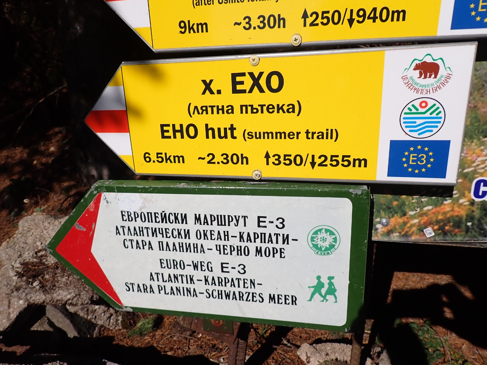
E3 signs.


Saturday, October 26, 2024

E3: Proboinitsa Hut to Kom Peak: Day 26

Today, I reached the end of the Kom-Emine trail on the summit of Kom Peak.

Although the omelette was lovely, the 8 o'clock breakfast made for a late start. Heading up the rocky track through the trees was easy at first gaining height slowly. Concrete tanks of dirty water, similar to ones I saw yesterday, were for fire fighting, according to a sign translated by Google. I missed the odd diversion off the main track without feeling I lost anything important. The route of the Kom-Emine then shrunk to a path and began climbing steeply. Leaving the trees behind it rose up at an even higher angle to the top of a ridge. From there, easy walking for several kilometres of grassland allowed me to enjoy the surrounding scenery. At the end of this plateau I could see Kom Peak in the distance, beyond another red and white TV tower.

First sight of Kom Peak.

Being Sunday people were about walking in ones, twos and small groups. One guy passed pushing his mountain bike up a hill, a motor bike driven by a person in bright yellow gear was repeatedly revving hard, and three Quad bikers raced by. I stopped at a restaurant on the Petrohan Pass for a kebab in bread and a Coke for lunch. The quad bikers were there, middle aged blokes like myself. One said something in Bulgarian and pointed to his head. I shrugged my shoulders in incomprehension. Later I realised I had a leaf stuck in my hair. 

A little before I reached the restaurant there had been a piped spring with a good stream of water. People were lined up with large, cooler sized, mineral water bottles waiting to fill them up. There seems a general preference for spring water compared with the municipal supply. I only needed to fill my one litre water bottle and I was kindly let in by the man at the spring. Not sure if the people in the queue behind felt quite so generous.

Leaving the busy road at the pass, I climbed up towards the TV Tower turning off left before I arrived onto a series of forest tracks and paths onto the treeless ridge on which Kom Peak lies. As the afternoon wore on, shadows lengthening, I made the final climb up to the summit. It was around 5 pm when I arrived, alone in empty space except for a small metal tower and a memorial to someone. A cold wind was blowing but visibility was good, I could see a lot of mountains, some I had walked over, others I had not. I took a few photos, emptied an annoying bit of grit out of my boot, celebrated with a Mars bar, then retraced my steps down to the ridge, quietly pleased with my achievement.

Looking back.


At the end of the Kom-Emine trail, summit of Kom Peak. 

The Bulgarian E3 ends at Kom Peak with the Kom-Emine trail, there was then a gap before the E3 continues in Rumania at the Djerdap dam, which both turns the Danube into a large artificial lake and links Serbia with Rumania. To reach this point from Kom I could have headed north on a road route used by the blogger "German Tourist", cross into Serbia then follow the E4 route to Djerdap. However, my plan was to follow a more southerly route via Dragoman. From there I would travel to Sofia and return home. Next year I would return to Dragoman, follow the Sultans Trail to Dimitrovgrad in Serbia, then travel up the E4 to Djerdap. This was a longer route, however it made it easier to split the trips, catching a flights to and from Sofia. In addition when I walked the E4 in Serbia a few years ago, a GPX track of the route had not been published. I managed to work out much of it from the book "Rambling through Serbia at a Slow Pace" published by the Mountaineering Association of Serbia, but I knew I went wrong in some places, for example, I never managed to climb Veliki Krs, a prominent ridge. A GPX track had now been published so I could follow the correct route.

My plan from Kom Peak was to follow a route I found online on the TEAR (Trans European Alpine Route) website to Dragoman and then catch a train to Sofia. Unfortunately the route started over long grass and juniper bushes for the first kilometre or so. I decided to avoid this section by following tracks on the map on my GPS. Of the first track I tried there was no trace. An adjacent track worked out but by now the sun was setting, lighting up the jet vapour trails high in the western sky. I pitched my tent on a spot selected just before the after light of the setting sun disappeared. Not ideal, tufts of vegetation are making lumps in the groundsheet, but it will do.

31.8 kilometres walked today with a total ascent of 1600 metres.


Friday, October 25, 2024

E3: Trastena Hut to Proboinitsa Hut: Day 24

A rather different day today with a lazy walk downhill to Gara Lakatnik, where I shopped and drank coffee, then a road walk up a valley to Proboinitsa Hut.

Breakfast was again French Toast with jam and white cheese, and again delicious! After saying "ciao" to my hosts I walked down to the village of Lakatnik along paths, dirt tracks and tracks roughly paved with stones no doubt long ago. A couple of forestry trucks passed me, they always seem to be painted a dull green like the old Land Rovers, with good clearances. The houses of Lakatnik nestled in a valley, at least one of them falling apart. In the main square there were two war memorials both relating to the First and Second World Wars. Beside one there was a light artillery piece of some sort, maybe an anti-aircraft gun. However I was heading for the sister village of Gara Lakatnik. 

Gara Lakatnik was on the eastern slope of the Iskar valley, called "Gara" as it contained a railway station. The valley contained the only major river that I would cross, the River Iskar which was unusual in that its source was to the south of the Balkan Mountains but it had eroded a gorge, presumably as the mountains were formed, so that it discharges to the north of them into the Danube. On the western side of the valley a series of cliffs rose up.

Gara Lakatnik is the village at the bottom of the valley, the cliffs are the other side of the River Iskar.

As I had plenty of time today, having a little over 20 kilometres to walk, I dawdled in Gara Lakatnik. First I stocked up with food for two nights camping, making three trips around the narrow aisles of the small general store to find everything I wanted, being careful my rucksack did not dislodge nuts, crisps or packets of pasta as I turned. Then I found a place selling coffee, which I drank while eating a small oblong of flaky pastry containing white cheese, which reminded me of similar snacks I had bought in Greece. I also had a look at the death notices that were pasted everywhere, onto lampposts, trees and notice boards. They gave the impression that everyone was dying in the village in some dreadful epidemic, but on closer examination, many were quite old. Each A4 notice had a picture of the deceased. Some looked happy, a few looked mischievous or seductive, others looked glum with downturned mouths. There were pictures of people too young to die, but maybe they used a flattering picture from their younger days.

The walk out of Gara Lakatnik was uncharacteristic of the Kom-Emine in that it went up a long, narrow valley. Initially it followed a tarmac road up the wooded dale, passing sporadic houses, some abandoned. Then the tarmac disappeared and it became a gravel road. Following the road made gaining height relatively painless as the gradient was gentle on the legs. There were a few places where the Kom-Emine decided to venture off into the trees. The first of these proved a struggle. Although the path started well, and may once have been a good track following telegraph poles, workmen had evidently been out recently chopping down all the trees beneath the power lines carried by the poles. This meant a large part of the path was covered with cut trees, their branches splayed out and interlocking to create a huge mess, extremely difficult to cross. I persevered with great difficulty and regained the road. The second such diversion off the road I decided not to attempt. The third bypass looked like it was long ago a section of the road, so I successfully climbed up it, avoiding a large switchback in the current road. I noticed some Michaelmas daisies beside the roadside and was frequently crunching acorns from overhanging oaks under my feet.

Road in the wooded valley up towards Proboinitsa hut.

Reaching my destination, Proboinitsa Hut, I noticed a lady with a video camera, a few other people and a car with a TV station written along the side. They had been filming and conducting an interview at the hut and highly recommended its food. I checked in and fortunately the lady in charge had some English. She had also been baking a cake. So I asked for a slice with my coffee. It was served with some vegetable (squash?) preserved in syrup. The hut had been recently renovated and for 40 lev (less than £20) I had a room of my own with ensuite facilities.

Having used Google Translate to decipher the menu I was able to ask for a salad, pork steak with chips, and a crème caramel. As the TV reporter had promised, the food was great.

22 kilometres walked today. 

Thursday, October 24, 2024

E3: Leskova to Trastena hut: Day 23

Another day among woodland and crossing high grassland. 

Again packing up before dawn, as I walked along I was treated to a spectacular display of pinks and oranges as the sun rose. Grey mountain ranges, stacked one behind the other, became progressively fainter as they met the awakening sky.

Stacked mountain ranges in the morning light.

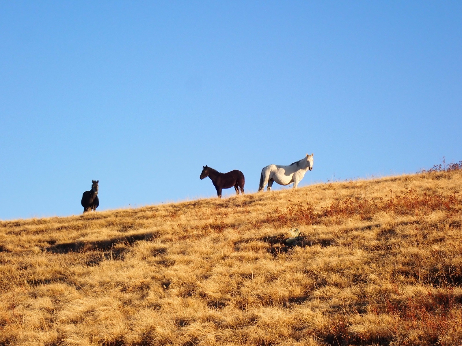
As I crossed a long section of grassland, marked by multiple ruts left by passing vehicles, I mused that people often ask me whether I listen to music as I walk along. The answer is no as it means I cannot hear things around me. The rustle of leaves beneath my feet, a distant vehicle, the clack of my trekking poles. I would have expected a "dawn chorus" of birds, but here they are largely silent. There are birds around, I have disturbed small flocks of small brown and cream birds that rise from the grass on my approach. Occasional crows "caw" as they glide above me. Today I saw two squealing birds performing an acrobatic display around each other. A herd of horses looked at me. Today the springs I visited were surrounded by a mess of mud made by their hooves.

Ruts in the grassland created by passing vehicles.

Horses on the skyline.

The season for red rosehips.

I reached Trastena hut to find it locked up. There was a phone number by the door but it just rang, then went to voicemail. After dropping a note to Lyuben explaining the problem, I sat and wrote up my blog and eventually two other people arrived with two children, also planning to stay at the hut. One of them got through on the phone and obtained the key and the friendly couple running the hut arrived an hour later having also been chased by Lyuben. I have just eaten my dinner beside a wood burning stove. The place is famous for its raspberry wine, as the hosts spoke no English I used Google Translate to ask for a glass. It was pleasant, although not exceptional. The family group staying here has grown with additional arrivals, however they are in a different dormitory so I am not sharing with anyone. The television was on, there is a general election in Bulgaria in three days time so there was a lot about that.

24.2 kilometres walked today, excluding a missed turn.

Wednesday, October 23, 2024

E3: One wild camping spot to another near Leskova: Day 22

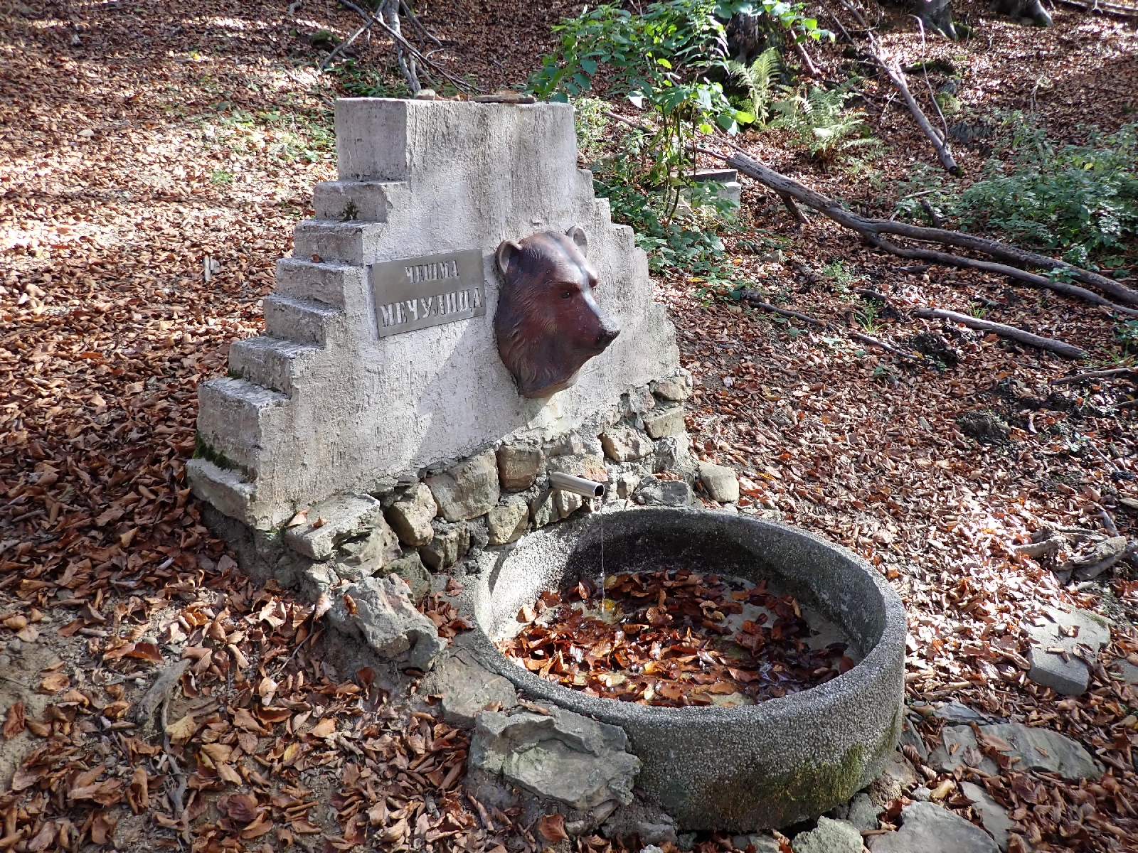
A sunny day through woods and over open land, with a helpful spring looked over by a bear.

It was still dark as I left my camping spot, days are getting shorter. From my position in the mountains I could look across at Sofia, maybe 40 kilometres away, a mass of twinkling lights, mainly white but with two noticeable red ones. The sun announced itself by lighting the eastern sky, turning the crossing vapour trails left by jets a pretty pink against a china blue sky.

Morning view to the north of cloud filled valley.

Much of the day was through woodland on tracks and paths. One section of track had been deliberately dug up, I assume to stop vehicles using it. A WWF (World Wide Fund for Nature) sign announced I was in an "Old Forest". The organisation is trying to preserve "primeval beech forest" in the Balkan peninsula and their associated biodiversity. There were also areas of grass, shortened by cows and horses, which allowed me to view the scenery to the north and south of me. To the north clouds covered the valleys while I enjoyed the sunshine. 

I needed to find water to replace what I had drunk, but the first of the two places marked on my GPS was completely dry. At the second there were just a few muddy puddles. I struck lucky at the third, a piped spring with a model of a bear's head sticking out from the stonework. A rickety table and benches by the spring gave me a place to enjoy my lunch.

Third time lucky, a working piped spring.

No sign of anyone today, no tarmac roads crossed, the area is remote. The trail has turned to the north west from its usual westerly trend as the mountain range curves up to the Serbian border.

More views.

I stopped early today, camping on Bigla mountain, tired and having completed 23.8 kilometres. Tomorrow I should reach Trastena hut.

Tuesday, October 22, 2024

E3: Chavdar hut to wild camping spot: Day 21

A return to walking through woodland and a visit to a village shop.

After a breakfast of cheese and tomatoes on toast, served with slivers of cucumber on the side, I paid my bill. It seemed low for the accommodation (albeit basic), lunch, dinner and breakfast. I tried to add a tip, but the Hut Keeper would only take a few Lev, returning the rest to me.

More trees!

Today my walk was at lower altitudes than recently and consequently all through woodland. Beech, oak, birch and pine, leaves on the first three turning yellow and brown with the changing season. I passed another monument to one of the battles that led to the liberation of Bulgaria from the Ottomans. This one, at the Arabakonak pass, recalled a battle in December 1877 when the Russians drove the Ottoman Army out of the area. Grass and weeds were growing in the paving around the monument and the flight of steps up to it.

Monument by Arabakonak pass.

I decided to follow the Kom-Emine cycle route to divert into the village of Gorno Kamartsi. The guidebook warned the hiking alternative was overgrown and reported that there was a shop in the village. I also felt I was missing something as the Kom-Emine trail visits few villages or towns. After following a tarmacked road down to the village I was disappointed to find the shop would not open until 15:30, over three hours away. Seeing me loitering around the shop a teenager on his bike indicated I should follow him to a "magazen" or shop (the Bulgarian word presumably lifted from the French). He led me up a side street, encouraging me to hurry. This shop was just about to close for lunch, so I quickly bought two apples, various types of chocolate, a small square of cake in a plastic wrapping and a Coke. I tried to ask the lad who helped me find the shop if he wanted anything, but could not get the message across. As the owner locked up I sat down at the table outside and drank my Coke and ate my cake. The lad had acquired a can of "Hell" (a soft drink) and was smoking and starring at me. In a combination of mime and a few words of English he asked me a few questions. He was surprised I was in my sixties and did not smoke. A lot of Bulgarians are heavy smokers, fortunately they stand outside the huts to smoke. He was only 15 I gathered. From his mime I think he was offering me lunch, which I declined, partly as I had some distance to walk, but also not wanting to get too involved. I had been reading Patrick Leigh-Fermor's account of his walk through Bulgaria during the 1930's in his book "The Broken Road". I was sure he would have accepted lunch, probably spent the night and learnt a few new Bulgarian phrases or customs. By comparison I felt cautious and fearful, not only that I might be robbed but that I would not know what to say and do, whether to offer to pay for lunch and if so how much. I am not comfortable in the close proximity of strangers who might expect some undefined, unknown behaviour from me. The teenager followed me on his bike as I left the shop making me worried that he would be difficult to separate from. Eventually he said "You me money please". I gave him some random coins from my pocket which seemed to satisfy him and he cycled off up a side street by a telegraph pole with a stork's nest on top of it (but no stork).

After following the road up to Vitinya Pass I turned off onto a good gravel track which I followed for a few hours. Two lorries of roughly chopped wood and a few pick ups passed me.

Rosehips beside my track.

As the sun lowered in the sky and having almost completed the 30 kilometres I planned, I turned off the road and found a nice flat spot to pitch my tent among the beech trees.

29.5 kilometres walked today.

Monday, October 21, 2024

E3: Murgana Hut to Chavdar Hut: Day 20

A short walk today in the sunshine with two dogs trying to follow me.

Breakfast was good this morning,  French Toast with jam and cheese, three slices! Also a yoghurt type drink, coffee and chai. A gave a healthy tip when leaving as although the drain in the bathroom was blocked, the food was plentiful and everything was clean.

While putting on my boots outside the hut, two dogs came up for a sniff. Evidently I smelt good enough for them to follow me as I walked back up to the trail. The hut keeper came after them, calling them back. They looked at her for a few seconds, then headed off up the path. I walked back down the hill to try and persuade them to return, but they were not going to fall for that trick. Seeing it was useless the hut keeper gave up and indicated I should continue on my way. Several times I thought I had lost the dogs but they just kept appearing at my side. One was a bitch of indeterminate breeding, her tit's elongated by feeding many puppies. The other looked half German Shepherd. I dislike dogs following me, trying to impose some responsibility for themselves on me.

As I climbed, an open cast copper mine came into view to my right. A great pit with terraces spiralling around the sides and the hum of machinery in its distant depths. I had read that a tunnel goes under the mountain with a conveyor belt carrying ore to be processed in the valley to my left. I wondered if the artificial lakes I could see were associated with treating the ore, and maybe the chimneys releasing plumes of steam were smelting it.

Elatsite copper mine.

Sofia, Bulgaria's capital, was to the west of me and I could see the mountain of Vitosha that rises behind it. Of the city itself, it was hidden beneath a blanket of haze covering the lowland plains. Between myself and the plains were the angular, tree covered foothills of the mountain range I was walking along. 

The mountain of Vitosha on the skyline, Sofia lies juts beneath it.

I viewed these things while sitting on a rock covered in lichen, mostly grey with lessor amounts of yellow and pale green. My resting place was set amongst grass with patches of low juniper intermingled with blueberry bushes dying back for the winter. Small pines were scattered across the hillside. Behind me was a boarded up building claiming to have video surveillance, which I doubted. On the next spur of the mountain a white horse stood out among a herd of black and chestnut animals. While sitting there, thinking such thoughts, the dogs finally disappeared, off to find some other distraction, sitting still was just no fun!

Today the trail was easy following a rough vehicle track. Bulldozed into the side of the mountain to create a flat surface it exposed stones and the underlying bedrock. When I looked closely I saw it was a quartzite, with some trace fossils of seabed burrows still visible. a little later the roadway revealed purple slate and then wavy fragments of green schist. It seemed an example of the many different rock types I had crossed when walking over this Balkan range.

In an area of grass, a stone memorial was surrounded by a green and yellow metal fence. A few trees grew in the enclosure. The monument was to commemorate the 841 soldiers and 18 officers, Russian and Bulgarian, who died in a snowstorm in 1877 attempting the cross the ridge.

As I continued on my way, small brown grasshoppers jumped out of my path. I descended down the hillside, re-entering the beech woods to reach Chavdar Hut. Unusually the hut keeper speaks some English, and provided me with bread and soup for lunch. I spent the afternoon reading my kindle. Dinner was four fried eggs served in the pan they were cooked in and reheated potatoes and carrots in another pan. I was hungry and ate them eagerly.

13.3 kilometres walked today.

Sunday, October 20, 2024

E3: Momina Polyana Hut to Murgana Hut: Day 19

Another fine day in the mountains, a bit shorter than previous days.

Over breakfast I exchanged a few words with a trio who were also walking the Kom-Emine but in the opposite direction to me. It was helpful that they were around as I could copy what they did, such as filling a mug of chai (tea) from a big saucepan keeping warm on top of the stove that was heating the room.

Stove used to heat restaurant.

Breakfast was late (8 am) but I only had 22 kilometres to walk today. Unfortunately, first I had a 300 metre climb from the hut back onto the ridge. On the climb I tried to zig-zag up the mountainside using the various paths, made difficult as the morning sun was shining into my eyes but the ground ahead of me was in dark shadow. Unfortunately the paths tended to disappear in juniper bushes or I just lost them. Throughout the day paths appeared and disappeared, and I frequently lost the one I should have been following. Horses were frequently responsible, creating paths parallel to the one I should be on. Horse poo was everywhere, along with older cowpats. After the initial climb to almost the top of Kartala Peak there was some walking on more or less horizontal ground. It was not to last, there were several steep descents and ascents over the day, as well as a length of path contouring the mountainside. Large stones and boulders on the route slowed me down. A line of men passed me each carrying a large bowl and carried what looked like a few plastic sacks on their backs. I assumed they going to pick some berries, maybe juniper, or I had seen some red berries in the undergrowth. We exchanged hellos but due to the lack of a common language I was not able to determine what they were about to harvest.

Looking north as I climbed up Kartala mountain.

As on previous days, views to the north and south were extensive. Lines of mountain extended into the distance getter progressively a whiter shade of grey. In a broad, flat bottomed valley immediately to the south there was the industrial town of Pirdop, steam from chimneys rising vertically into the still air. At times the cold wind picked up. The morning started with frost whitening all the grasses, the frozen mud crunched under my feet, but once the sun was up the frost disappeared except in the shadows.

Pirdop industry in the valley.


Ridge I was following.

As I knew the distance was not great today I sat down to admire the view more often, getting through my supply of snacks in the process. Towards the end of the day the route dropped down to the Kashana Pass and a return to woodland and beech forest. As the sun lowered in the sky I became impatient to arrive. I left the Kom-Emine trail and walked through woods to the Murgana Hut, which had a impressive view over the valley below from its veranda. On being shown to my room I decided a shower was in order. As is typical in these places the shower was with the toilet in a "wet room" affair. Unfortunately I failed to notice the water was not draining away. Soon the bathroom was flooded. A squeezy mop was leaving against the wall and I spent half an hour using this to empty the bathroom of standing water. Fortunately only a little had escaped to the corridor outside.

Dinner was a more successful affair, after the extensive use of Google Translate I had chicken soup, salad and a pork steak with a few chips. Unfortunately my phone charger has broken. I had been blaming Bulgarian plugs for not working but with the help of a bedside lamp I have shown my charger is at fault. I have a fully charged power pack but am not sure how long that will last.

22.7 kilometres walked today and over 1000 metres of ascent.

Saturday, October 19, 2024

E3: Echo hut to Momina Polyana Hut: Day 18

Another day of fine hiking in sunny weather, although a little tiring.

A later start today as the kitchen did not open until 7:30 am. I obtained a coffee but the promised French Toast seemed delayed. After not wanting to eat much at the start of this trip my appetite had now recovered. The smell and sound of cooking made me feel acutely hungry. I resorted to standing around the hatch, through which food was passed from the kitchen to the restaurant. Although they would have been only able to see the middle of my body, it seemed to work and my breakfast appeared.

Having eaten, I brushed my teeth and used the toilet, hoping no-one else wanted it as there was no lock. Then I gathered with some other walkers in the porch where we put our boots on. One of the others pointed out a herd of deer on the side of the mountain. A few horses were grazing nearby.

Eho hut.

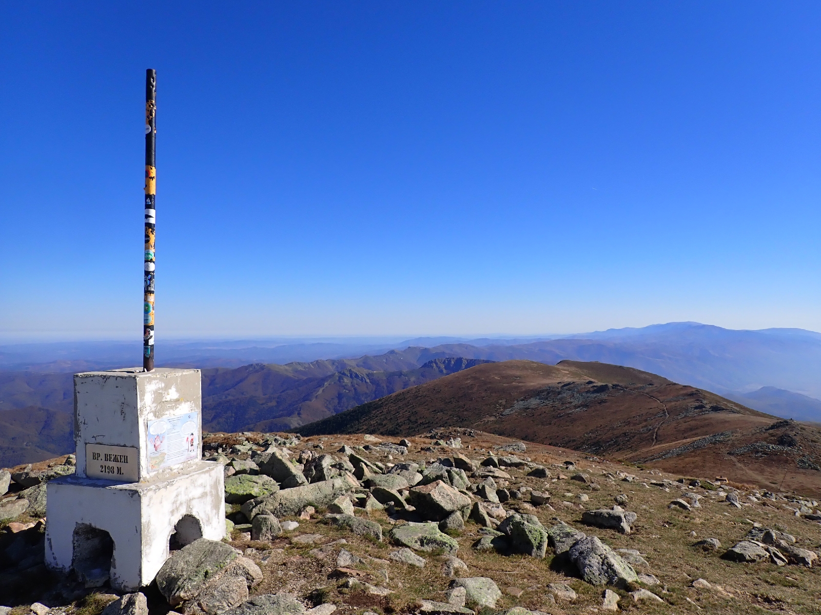
I set off along the side of the mountain but was soon climbing. The route involved crossing a number of peaks, each one seemed higher than the last until I reached the summit of Mount Vezhen at 2198 metres. Looking back I could see the TV Tower on Botev Peak in the distance,  two days walk away, and the Arch of Freedom a little nearer. To the south I wondered which of the hazy grey mountains on the horizon was Vitosha, which rises up behind the capital Sofia. Eho hut and Kozya Stena hut were also visible as white spots. Where possible I took the "Summer routes", bypassing a few peaks. In one case I accidentally followed a path which was leaving the mountain. I had to double back on another path before I lost height.

View from Mount Vezhen.

View to south from Mount Vezhen, are those the Rhodope mountains on the horizon?

After further peaks I reached the abandoned Planinski Izvori hut. Still standing but without windows. Here I left the ridge to walk down to Momina Polyana Hut. Juniper bushes were trying to close the path, streams and boulders made my progress slow. I felt disgruntled that I had to loose 300 metres in height to go to the hut. When I arrived I found many vehicles parked outside, music playing and lots of people about. After finding the hut keeper in the kitchen, she showed me to my room. Unfortunately I could not find my way back to the entrance I came in on. It seems there is an old and new part of the hut but I could not work out how to cross between without walking around the outside. Fortunately the large noisy party was in one part, myself and a few others were in the other part.

I did find a restaurant area and thanks to a girl speaking English I ordered a salad, soup and an omelette. The salad of cabbage and carrots was large, and I failed to finish it.

26.4 kilometres walked today with over 1400 metres of ascent.

Friday, October 18, 2024

E3: Dobrila Hut to Eho Hut: Day 17

A lovely, sunny walk in the high mountains, if a little long.

As I knew it was a long day I started early when it was still dark. Looking down from the mountains to the plain below I could see a myriad of lights, pin pricks of orange and white that made it look like a metropolis was there, rather than a few small towns. A band of blood red marked the horizon and the imminent arrival of the sun. Frost sparkled in the light of my head torch.  

For a few kilometres I walked through conifers, heavy with pine cones. As the sky lightened the birds started chattering to each other. In less forested areas I could see a large moon setting. I progressed into beech woods before arriving at Dermenka Hut. The door was open and I put my head in to see if a coffee might be available but no-one was around, just the sound of a distant vacuum cleaner. 

For the rest of the day I was walking above the trees, initially on close cropped grass. Wide views stretched each side to mountain ranges and plains. Today winter and summer routes often split. I discovered the winter routes, marked by poles, were not always suitable for walking along as they crossed rocks, juniper bushes and other hindrances to progress on two feet. They were intended for use by skiers when covered by snow. When following a winter route a little before Orlovo Gnezdo hut I was forced to give up and awkwardly clamber down to a nearby gravel road. The door to Orlovo Gnezdo hut was also open, but again no-one was around so I sat outside and ate a chocolate bar from my stocks. The poles now often had small plates showing the compass bearing to the next pole, for use when visibility was extremely poor I assumed.

A view of towns in the flat bottomed valley below.

Following the gravel road and then a good track I soon reached my tourist site for the day, the "Arch of Freedom". Celebrating both liberation from the Ottomans and the end of the Second World War, it was clearly of the Soviet, hero monument style. I was not surprised to see that this 34 metre high arch was built in 1981, before the end of communism in Bulgaria. The chiselled, tough looking men sculptured into the base reminded me of Soviet sculptures I had seen in Uzbekistan. 

The Arch of Freedom.

More peaks followed the Arch, some were scarred by people driving their 4 wheel drives up them, the ruts created by their wheels enlarged by the flow of water. The National Park authorities seemed to be making efforts to correct the damage by placing fences around the worst sections and adding stone mattresses to stop the flow of stones and earth downhill. I noticed they had also installed vertical pipes, filled with concrete as a barrier to prevent vehicles entering areas they were seeking to protect.

The mountains became increasingly steep sided and rocky. A kite type hang glider circled high above the valley. A flock of pigeons (?) wheeled in the air below me. Fortunately the Summer Route bypassed most of the peaks saving me effort. Herds of horses roamed the area. Not wild as at least one in each herd wore a clanging bell. They looked sleek and well fed. One was standing on my path, alarmed it trotted off, crushing the juniper bushes as it made its escape, which released an aromatic scent of pines and gin. The route led around a steep slope, unfortunately the horses had complicated navigation by creating multiple paths so it was difficult to know which was the correct one. Small outcrops also interfered, slowing me down as I carefully climbed over rocks. Juniper branches attempted to close the path, rubbing against me as I passed, trying to hold me back, hiding roots that might trip me and loose stones on which I could stumble.

Horses on the high ridge.

For such reasons it took me longer than expected to reach Kozya Stena hut. Here there were people eating and drinking tea, so I bought a Coke and chocolate to consume while admiring the view. I left with a group of three young men who spoke English. We swapped questions as to where we were going. They were heading for a different hut and soon out-paced me. As I looked at them disappearing in the distance, I rationalised that they were younger, had smaller packs and had likely not been walking for so many hours. I also reminded myself that it was not a race.

Although I looked forward to arriving at Eho hut for the night, I could not help admiring the way the late afternoon light backlit the rocks, how the low sun revealed the structure of the valleys and turned the leaves of the beech trees to a luminous gold. The valleys are "V" shaped and the ridges between them form an equally sharp, upside down "V" unless some geological feature disturbed the pattern.

"V" shaped valleys between ridges shaped as an upside down "V".

Eho hut appeared at the last moment over the brow of a ridge. I was fortunate that there were a couple of people staying at the hut who spoke English. It made it easier to get a bed and some food. In the evening there was quite a party in the restaurant area, complete with music. They were celebrating a birthday. There were also couples and friends out for a weekend walking.

32.1 kilometres walked today with an ascent of over 1300 metres.

Thursday, October 17, 2024

E3: Botev Shelter to Dobrila Hut: Day 16

A fantastic if slightly scary day walking along high ridge tops, looking down on the clouds.

I had difficulty getting to sleep last night and kept wanting to pee, which necessitated walking 30 metres to the outside toilet. I am sure I never drank the amount that I peed out. Until midnight, I had to pass a Bulgarian group who talked late into the night, occasionally gathering in the outer lobby (where the Alsatian dog and furry cat were trying to sleep) to smoke cigarettes.

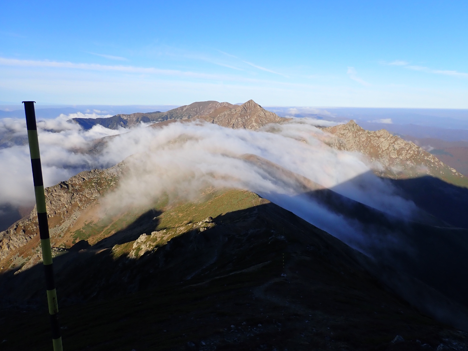
However breakfast was good, three slices of French Toast with a berry conserve. Then I started climbing. As I climbed the ridge the views were amazing. Fluffy clouds spread out below me to the south, their tops being lit by the rising sun, pink then brilliant white. To the north, still in the shadow of Botev Peak, cloud filled valleys looked like white lakes. The first few peaks of the ridge were covered with closely cropped grass in which tiny yellow flowers were occasionally scattered (Alpine Cinquefoil according to PlantNet). On the horizon a chamois was crossing the hill, one of two I saw today. A cold, inconsistent wind was blowing.

Looking down on clouds to the south as I climbed out of the saddle where Botev Shelter lay.

I passed two waypoints on my GPS suggesting I could leave the ridge at these points if the weather was bad. However the breeze was loosing its strength, the weather was sunny with visibility only obscured occasionally by clouds crossing the ridge. So it was safe to continue and admire the views north and south. Mostly clouds to the south with a mountain range a long, long way away poking above them. To the north there were hills and valleys, many covered with rust coloured trees.

Clouds being blown across the ridge I was following.

Then the difficult bits started. There was an awkward scramble down a short rock face, then a struggle to find the right path. The route led onto a side ridge that I was confusing with the ridge I should actually be following. I eventually realised that the path turned back on itself over a minor summit. There was then more scrambling up and down rocks. Nothing too difficult, the rocks were solid and dry, but when you are on your own, you know there is no-one to help you if you get into trouble. 

The most difficult part was the climb up Koupena Peak. Wire rope was attached to the rock so you could pull yourself up. After several scrambling sections, using hands and feet, cautiously reaching from one hand or foot hold to the next, I reached the top. There I joined three others, walking the Kom-Emine from the other direction. We sat there admiring the sea of clouds before us from our high perch. There were more wires to help me down the other side, before a long slog up the grass of the next peak. On the final peak there was a colourful painted emergency shelter. Behind a sheet of glass there a gas canister, a bottle of water and a bottle of Gibsons Gin (?) for emergencies. 

Kom-Emine trekkers on the summit of Koupena.


Looking back at the ridge I followed.


Dobrila Hut differs from the other huts I visited in that it is new, could be booked online, and bits clearly needed finishing. I arrived in time for a late lunch and then indulged in a shower in my bedroom's "ensuite" facilities. A good diner followed, unfortunately the plug sockets did not work so I will need to charge my stuff at the next hut. (As I discovered a few days later it was my phone charger that had failed and not the plugs).

14.2 kilometres walked with a total ascent of just over 1000 metres.


Tuesday, October 15, 2024

E3: Tyzha Hut to Botev Shelter: Day 15

Today I reached the top of Botev Peak, the highest point on the Kom-Emine trail.

View from Botev Peak.

Breakfast was again scrumptious French Toast with jam and cheese served with tea (chai). Tastes like they add mint to the tea. Then it was a morning of hard climbing to reach the top of Botev Peak. At first I was following a path which had cut a groove into the earth between bushes of creeping juniper which covered the hillside. Then I joined an eroded track of loose white stone rising over the open hillside. A gravel road crossed my track a number of times, and I saw a few pick ups drive up and down to the buildings on top of Botev Peak. The road went through many switchbacks to climb the mountain but my track just went straight up. Navigating was not difficult as there were numerous poles to guide me, poles intended to assist when the ground was covered with snow. Steep climbs alternated with more gentle sections. I had plenty of time today so I climbed slowly, briefly resting after every few poles on the more vertical sections and admiring the scenery. There was a cold wind so I was well wrapped up, but if I exerted myself too much I overheated. The wind was bringing in clouds from the north which eventually swept across the top of the mountain so that when I finally reached the flatter area around the summit, I could only see the next pole ahead of me. 

Botev Peak before the clouds moved in, note the red and white television tower on top.


A monument materialized through the mist, decorated with images of three ice axes. It commemorated three people who died on New Year's Day 1955. Some time after much bigger buildings took shape in the whiteness around me, these included a red and white TV tower looking a bit like a rocket. The guidebook said you could get a cup of tea here. I tried a few doors without success, then spotted a sign in Bulgarian indicating something was 50 metres away. It was a little shack, where a man who had lived in Weston-super-Mare, that British seaside town, for 9 months served me tea and lentil soup with which I celebrated reaching Botev Peak. At 2375 metres it is the highest mountain on the Kom-Emine Trail and roughly the halfway point.

When I left the clouds had cleared on my side of the mountain. Descending steeply on eroded paths, loose rocks tumbling down, I tried, largely unsuccessfully, to find the path which the GPS said zigzagged down. In the saddle at the bottom I found Botev Shelter, where I am sleeping for the night (it is a proper manned hut, not just an emergency shelter). A group of Bulgarian men and one woman was having a picnic outside the hut. When I went inside the hut keeper shooed me away with his sweeping brush, so I sat outside until he was free. Through heavy use of Google Translate and the assistance of the lady picknicker we established I would eat at 7 pm and I was shown the dormitory where I would be sleeping. Unfortunately the toilet is a hole in a concrete floor in an outbuilding.

It transpired that the picnicking party were staying the night, although in a different dormitory to me. From 1 pm to late they sat and talked, argued and laughed, multiple voices at the same time, picking on a table full of food they had evidently brought with them. What they could talk about for so long I could not imagine. Some of them had sweatshirts with the Bulgarian Tourist Club logo on, the organisation that runs most of the huts.

After a pork and potato stew, that could have been reheated a bit longer, and a crème caramel, and lots of reading on my kindle I am now heading for bed, hoping I do not have to use the outside loo at night...

A very short day at 11.6 kilometres although with over 1100 metres of ascent.

PS although I was worried that the under heated stew might give me food poisoning I was reassured on seeing a box of "Kilner" type jars filled with stew. Presumably there was some central kitchen that cooks the food and puts it into sterilized jars which are sealed. All the hut keeper then has to do is heat up the food.

E3: Partizanska Pesen Hut to Tyzha Hut: Day 14

A sunny day with great views.

A kind of French Toast topped with a berry conserve and a piece of cheese was served for breakfast which I much appreciated. As it was not a long day today I took my time. It was a shame to leave such a nice place, although the Golden Retriever was a bit upset not to get any food off me, despite resting his head on my lap and looking at me mournfully. The white cat just sat next to me and gloated.

I was not the only person heading up the path today, four people on a day hike were going the same way with their small dog (some kind of cocker spaniel cross). Over the day I saw a few people on the trail, including a runner and a group of three backpacking like me. At first I followed tracks and paths through woodland and beech forest in autumn leaf - up, down and beside hills. Later in the day I entered the Central Balkan National Park and more open areas of grassland as I progressed to higher ground. From these heights I could see across Bulgaria. The tree covered valleys below me looked especially attractive, the trees now a golden or reddish colour with the progress of the season. In addition to the added interest of looking at blue, mountain ranges on the horizon, the views made me feel I was really high up. When you are among trees it is difficult to get a perspective of height and space, your vision is limited to leaves, lines of trunks and the rustling leaf litter your feet are disturbing as you walk.

On this higher, open ground a noticeboard said it was kept tree free by traditional grazing (that would explain the lack of conifer trees that you normally find before treeless high ground). In addition to rough grass there were large areas of spreading juniper. There were few flowers this late in the season, but among the few were blue campanulas, so characteristic of high altitudes.

I was "welcomed" by a barking dog at Mazalet hut. Although just after 11 am I thought I would try and get some soup for an early lunch, there would be no other opportunities. On wandering around the building I found a hatch where you could order food. After poking me head in and calling out hello for a while, a man appeared carrying a big saucepan. After the man mimicked the options (rubbing his belly to indicate pork belly soup), I chose lentil soup and a coffee. Soup was good although a gust of wind blew half of the coffee over my trousers. Annoying, fortunately my trousers are black so the stain should not show, not much chance of washing them for a while. I was soon joined by other customers enjoying the sunny weather, although quite cool in the wind.

Mazalet hut.

A little after Mazalet hut the path rose up a ferociously steep slope, steps had been constructed in places to help and there were outcrops of rock to cross. A complete change to my trip so far. My efforts in struggling up the mountainside were rewarded by the ever larger field of view. In two places the "summer route" allowed me to bypass a peak, but in general it was pretty brutal. On one rocky summit there was a star shaped memorial to some passed away person, complete with his boots, a serviceable ice axe and can of beer.

Ever increasing views as I climbed higher.

With time everything comes to you if you keep plodding on, and I eventually crested the mountain. Beyond I could see my target for tomorrow, Botev Peak, an even higher mountain and the highest point on the Kom-Emine trail. Then all my effort in climbing the mountain seemed wasted as I descended into a valley down a steep path. 

To reach my hut (Tyzha Hut) for the night it was then a gentle walk up a side valley fording a few streams, splashing through rather than trying to keep my boots dry. The final section was a steep path with helpful steps but two unhelpful dogs. These large animals barked at me all the way to the hut. Maybe they would not harm me but their aggressive barking was not nice. The hut keeper showed me to my dormitory. Again I am alone in the hut, October being late in the season. I was a bit confused as usually two sheets are provided, along with blankets for you to make up the bed, but here only one per bed was laid out. I might just sleep in my sleeping bag. Dinner at least was plentiful. I ordered both the soup and the salad, followed by three "burgers" (kofte) and three slices of bread. I think I am getting the idea of ordering! It was odd sitting in the "restaurant" area with just the hut keeper. This was the only really warm area of the hut as there was a large wood burning stove. Then a friend of his joined us, a nearby farmer maybe, the place is remote but I passed a flock of sheep on a nearby hillside. We all sat watching a silly game show on television, where the blue, yellow and green team competed in a sort of obstacle race on a beach.

21.4 kilometres walked today with just over 1000 metres of ascent.

Monday, October 14, 2024

E3 Day: Old Buzludzha Hut to Partizanska Pesen Hut: Day 13

Sightseeing monuments today, as I continued west on the Balkan Mountains.

After a breakfast of fresh, salty bread and yoghurt I viewed various Soviet era monuments. There was a large "sculpture" near the hut including the communist hammer and sickle, beside a raised plaza. However, the principal monument was on top of the hill. The star embossed on the tower of the "Memorial House of the Communist Party" looked down on Little Buzludzha Hut where I stayed the night. I walked up to this giant memorial following a "crazy paving" path (reminding me of our garden patio back in the 1970's). Entry into the building was blocked by metal bars and prohibited, but the scale of the building and its triumphalist setting impressed when you were close up. Built in 1981 it was abandoned in 1989 when the "Iron Curtain", the barrier restricting movement between the capitalist west from the communist east, fell. Now slowly decaying, the building's 70 metre tower and circular, ceremonial hall was visible from long distances. Conversely, standing by the structure, high in the mountains, I could see across the central lowlands of Bulgaria to mountain ranges far to the south, as well as back to the mountains I had climbed and forward to those yet to come. On walking down I passed a final sculpture from this period of two hands both holding flaming torches, no doubt with some deep symbolism.

"Memorial House of the Communist Party" above the Old Buzludzha Hut.

View from the Communist monument.

Paths and roads through woodland led me over a few hills to the mountain of Shipka Peak. Major battles were fought here in 1877 as part of the Russo-Turkish war that led to independence for Bulgaria. To commemorate this success the "Monument to Freedom" was built, essentially a square tower on the summit with lots of steps leading up to it. There is a museum inside and the bones of soldiers but I decided against going in. Nearby was another monument, this time surrounded by ancient artillery pieces, the Monument of the Steel Battery.

The "Monument to Freedom" on Shipka Peak.

Satisfied with my exploration of history, I walked down to the café cum souvenir shop on the road over Shipka Pass for a coffee, orange juice and Mars bar. More walking through trees followed until I reached Uzana. Here there was a plain of close cropped grass. An information board indicated a plethora of buildings offering accommodation but the ones I passed all looked closed. Somewhere nearby was the geographic centre of Bulgaria, marked by a modern monument. As it seemed an abstract concept I did not divert to see it, however I did wonder how it was defined. Was it the point equidistant from the countries borders in the north-south and east-west directions, or was it area weighted, i.e. equal areas of Bulgaria east and west of the point and north and south of it?

My next stop was Partizanska Pesen Hut (also referred to as Yantra hut), but I was somewhat perturbed by the lack of signs, compared with those for other huts. Two of the rare signs I spotted were pointing in the direction which I had just walked from, although someone had tried to paint them blue... After crosschecking my GPS waypoint for the hut with where Google thought the hut was I carried on and found it where I thought it was. More of a hotel than a hut.

Much of today has been through woods and over hills, similar to the past 12 days, however there were some open stretches and summits allowing me to see the hills, valleys, plains and towns beyond my immediate surroundings. The weather is changing. Today a cool, gusty wind made me feel cold at times so I was wearing another layer, but when the wind died down or I was more sheltered I overheated as I climbed up another forest track. The forecast looks cool for the days ahead so I may be digging out some warmer clothes.

I have not quite got the hang of ordering dinner, I manage a good salad, a piece of meat, some bread, but things like potatoes are missing....

These poles were placed along the Kom-Emine trail to help skiers find their way when snow covers the ground.


25 kilometres completed today including over a 1000 metres of ascent.

Prague and return home: Day 184 &5

An informative day spent seeing Prague, followed by my return home. I joined a walking tour of Prague this morning (feeling that...