Tuesday, October 15, 2024

E3: Partizanska Pesen Hut to Tyzha Hut: Day 14

A sunny day with great views.

A kind of French Toast topped with a berry conserve and a piece of cheese was served for breakfast which I much appreciated. As it was not a long day today I took my time. It was a shame to leave such a nice place, although the Golden Retriever was a bit upset not to get any food off me, despite resting his head on my lap and looking at me mournfully. The white cat just sat next to me and gloated.

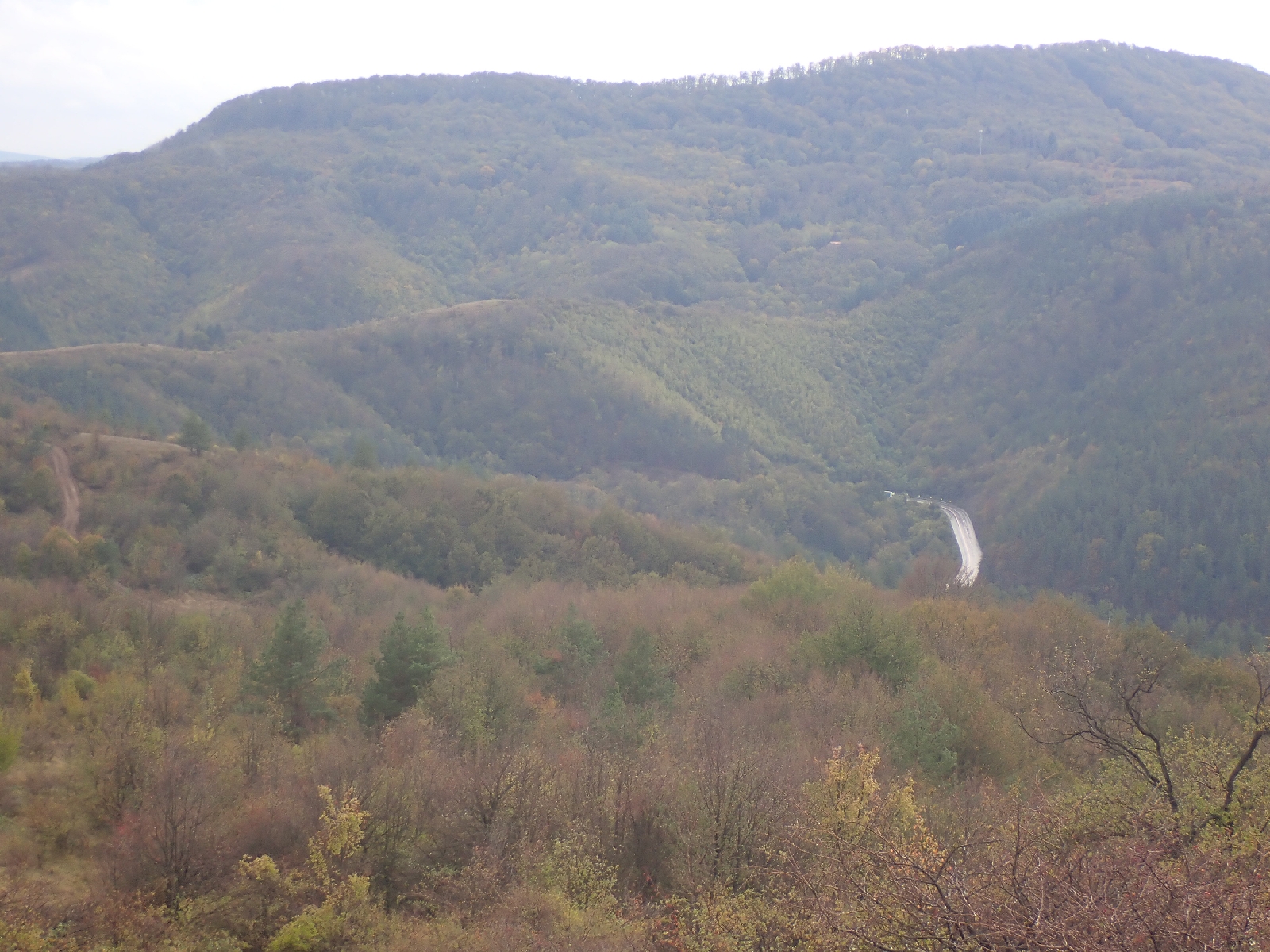
I was not the only person heading up the path today, four people on a day hike were going the same way with their small dog (some kind of cocker spaniel cross). Over the day I saw a few people on the trail, including a runner and a group of three backpacking like me. At first I followed tracks and paths through woodland and beech forest in autumn leaf - up, down and beside hills. Later in the day I entered the Central Balkan National Park and more open areas of grassland as I progressed to higher ground. From these heights I could see across Bulgaria. The tree covered valleys below me looked especially attractive, the trees now a golden or reddish colour with the progress of the season. In addition to the added interest of looking at blue, mountain ranges on the horizon, the views made me feel I was really high up. When you are among trees it is difficult to get a perspective of height and space, your vision is limited to leaves, lines of trunks and the rustling leaf litter your feet are disturbing as you walk.

On this higher, open ground a noticeboard said it was kept tree free by traditional grazing (that would explain the lack of conifer trees that you normally find before treeless high ground). In addition to rough grass there were large areas of spreading juniper. There were few flowers this late in the season, but among the few were blue campanulas, so characteristic of high altitudes.

I was "welcomed" by a barking dog at Mazalet hut. Although just after 11 am I thought I would try and get some soup for an early lunch, there would be no other opportunities. On wandering around the building I found a hatch where you could order food. After poking me head in and calling out hello for a while, a man appeared carrying a big saucepan. After the man mimicked the options (rubbing his belly to indicate pork belly soup), I chose lentil soup and a coffee. Soup was good although a gust of wind blew half of the coffee over my trousers. Annoying, fortunately my trousers are black so the stain should not show, not much chance of washing them for a while. I was soon joined by other customers enjoying the sunny weather, although quite cool in the wind.

Mazalet hut.

A little after Mazalet hut the path rose up a ferociously steep slope, steps had been constructed in places to help and there were outcrops of rock to cross. A complete change to my trip so far. My efforts in struggling up the mountainside were rewarded by the ever larger field of view. In two places the "summer route" allowed me to bypass a peak, but in general it was pretty brutal. On one rocky summit there was a star shaped memorial to some passed away person, complete with his boots, a serviceable ice axe and can of beer.

Ever increasing views as I climbed higher.

With time everything comes to you if you keep plodding on, and I eventually crested the mountain. Beyond I could see my target for tomorrow, Botev Peak, an even higher mountain and the highest point on the Kom-Emine trail. Then all my effort in climbing the mountain seemed wasted as I descended into a valley down a steep path. 

To reach my hut (Tyzha Hut) for the night it was then a gentle walk up a side valley fording a few streams, splashing through rather than trying to keep my boots dry. The final section was a steep path with helpful steps but two unhelpful dogs. These large animals barked at me all the way to the hut. Maybe they would not harm me but their aggressive barking was not nice. The hut keeper showed me to my dormitory. Again I am alone in the hut, October being late in the season. I was a bit confused as usually two sheets are provided, along with blankets for you to make up the bed, but here only one per bed was laid out. I might just sleep in my sleeping bag. Dinner at least was plentiful. I ordered both the soup and the salad, followed by three "burgers" (kofte) and three slices of bread. I think I am getting the idea of ordering! It was odd sitting in the "restaurant" area with just the hut keeper. This was the only really warm area of the hut as there was a large wood burning stove. Then a friend of his joined us, a nearby farmer maybe, the place is remote but I passed a flock of sheep on a nearby hillside. We all sat watching a silly game show on television, where the blue, yellow and green team competed in a sort of obstacle race on a beach.

21.4 kilometres walked today with just over 1000 metres of ascent.

Monday, October 14, 2024

E3 Day: Old Buzludzha Hut to Partizanska Pesen Hut: Day 13

Sightseeing monuments today, as I continued west on the Balkan Mountains.

After a breakfast of fresh, salty bread and yoghurt I viewed various Soviet era monuments. There was a large "sculpture" near the hut including the communist hammer and sickle, beside a raised plaza. However, the principal monument was on top of the hill. The star embossed on the tower of the "Memorial House of the Communist Party" looked down on Little Buzludzha Hut where I stayed the night. I walked up to this giant memorial following a "crazy paving" path (reminding me of our garden patio back in the 1970's). Entry into the building was blocked by metal bars and prohibited, but the scale of the building and its triumphalist setting impressed when you were close up. Built in 1981 it was abandoned in 1989 when the "Iron Curtain", the barrier restricting movement between the capitalist west from the communist east, fell. Now slowly decaying, the building's 70 metre tower and circular, ceremonial hall was visible from long distances. Conversely, standing by the structure, high in the mountains, I could see across the central lowlands of Bulgaria to mountain ranges far to the south, as well as back to the mountains I had climbed and forward to those yet to come. On walking down I passed a final sculpture from this period of two hands both holding flaming torches, no doubt with some deep symbolism.

"Memorial House of the Communist Party" above the Old Buzludzha Hut.

View from the Communist monument.

Paths and roads through woodland led me over a few hills to the mountain of Shipka Peak. Major battles were fought here in 1877 as part of the Russo-Turkish war that led to independence for Bulgaria. To commemorate this success the "Monument to Freedom" was built, essentially a square tower on the summit with lots of steps leading up to it. There is a museum inside and the bones of soldiers but I decided against going in. Nearby was another monument, this time surrounded by ancient artillery pieces, the Monument of the Steel Battery.

The "Monument to Freedom" on Shipka Peak.

Satisfied with my exploration of history, I walked down to the café cum souvenir shop on the road over Shipka Pass for a coffee, orange juice and Mars bar. More walking through trees followed until I reached Uzana. Here there was a plain of close cropped grass. An information board indicated a plethora of buildings offering accommodation but the ones I passed all looked closed. Somewhere nearby was the geographic centre of Bulgaria, marked by a modern monument. As it seemed an abstract concept I did not divert to see it, however I did wonder how it was defined. Was it the point equidistant from the countries borders in the north-south and east-west directions, or was it area weighted, i.e. equal areas of Bulgaria east and west of the point and north and south of it?

My next stop was Partizanska Pesen Hut (also referred to as Yantra hut), but I was somewhat perturbed by the lack of signs, compared with those for other huts. Two of the rare signs I spotted were pointing in the direction which I had just walked from, although someone had tried to paint them blue... After crosschecking my GPS waypoint for the hut with where Google thought the hut was I carried on and found it where I thought it was. More of a hotel than a hut.

Much of today has been through woods and over hills, similar to the past 12 days, however there were some open stretches and summits allowing me to see the hills, valleys, plains and towns beyond my immediate surroundings. The weather is changing. Today a cool, gusty wind made me feel cold at times so I was wearing another layer, but when the wind died down or I was more sheltered I overheated as I climbed up another forest track. The forecast looks cool for the days ahead so I may be digging out some warmer clothes.

I have not quite got the hang of ordering dinner, I manage a good salad, a piece of meat, some bread, but things like potatoes are missing....

These poles were placed along the Kom-Emine trail to help skiers find their way when snow covers the ground.


25 kilometres completed today including over a 1000 metres of ascent.
Sunday, October 13, 2024

E3: Himik hut to Old Buzludzha hut: Day 12

A fine day with a railway station, soup for lunch at a hut and a wind farm.

I woke late, it was already 7 pm, the time at which I had ordered breakfast. Rushing to the restaurant area I found a cooked breakfast waiting for me. Fried egg, sausage, cheese, bread and coffee, it was much appreciated.

Today was not all beech forest, there were areas of hawthorn, the berries crimson, and a few bushes of scarlet rosehips. In the morning there were also breaks in the trees where I could look down on clouds in the valley to the north, and beyond to a far away town.

Morning view of clouds in the valleys to the north.

After paths only detectable by the red and white waymarks, I reached Krastet railway station. I watched a graffiti coated train pulled in. Krastets was once a mining town, now the houses have been abandoned and ivy and brambles are slowly engulfing them. A group of three people with bikes got off the train, and headed off for a ride. Being Sunday there were people out walking the trail for a couple of hours, and a few were out exercising their 4 x 4's.

Next milestone, after more trees, was Bylgarka hut. There were people at tables on the veranda of the hut so I went up and bought a bowl of pork belly soup, which seems a local speciality, served with thick toasted bread (crisp on the outside, soft in the middle). I enjoyed it except for the fatty bits at the bottom of the bowl, which I ate anyway as part of the experience. After much more climbing up wooded hills I reached a windfarm. In the light breeze the arms of the turbines were barely moving, but did so with a creaking, squealing noise which did not sound too good. As it was on an open hillside there were grand views over tree covered hills to distant towns. I could see a gigantic Soviet Monument on a hilltop, that was above the location of my hut for the night. It looked a long way away.

More views.

As I walked down a road in the late afternoon light, I admired the beech trees, their leaves now turning with the ending of summer. Yellow, green and brown leaves, fluttered in the zephyr. They seemed insubstantial as they spread out in horizontal sweeps, contrasting with the lines of solid grey trunks, their verticality emphasised by the lowering sun illuminating one side of the trunk while the other was in shadow.

Beech trees in the late afternoon light.

Lyuben had booked me into the Old Buzludzha hut, however at the location indicated on my GPS the sign said "Small Buzludzha" which I assumed was the same thing. The Soviet Monument is directly above and there is some Soviet stone carving below that I will examine tomorrow. However on going into the hut they claimed I had no reservation, it seemed they had forgotten me. Nevertheless, they showed me to a dormitory and I ordered a salad and meatballs (i.e. burgers) soon after in case they should close the kitchen, which I ate with a beer in a cosy area with TV (not the official restaurant). The dormitory (of which I am the only resident) was grossly overheated by an Soviet era "radiator" with no off switch. Fortunately it later cooled down and I made good use of the clean and modern bathroom.

31.4 kilometres walked today with a total ascent of over 1450 metres.

Saturday, October 12, 2024

E3: Chumerna Hut to Himik Hut: Day 11

A misty morning among the trees, then down to the Prohoda na Republikata Pass for a very late lunch.

Last night I managed to communicate to the hut keeper that, in answer to his question (translated by Google), I planned to leave at 7:00 am (which is first light). For this reason he was around at 6:45 and I took the opportunity to buy a coffee off him and a "7 Day" chocolate croissant (a brand where long life croissants come in a sealed plastic bag). I saw the croissant bag on a shelf beside him, so it was easy to point to it.

An easier day today as, although there were uphill sections, it was downhill overall. The morning was spent in a thick mist and I was relying on my GPS to get me on the right track. Unfortunately it was playing up, however turning it off then turning it on again solved the problem. The massed trees, silently standing, softened by the grey mist had an attractive air; or maybe I just liked them as it was a change from how they looked for the previous ten days. It was another day walking through woods, mainly beech but areas of other types too. In the afternoon the mist cleared and there was intermittent rain. 

Trees in the morning mist.


Sign eating tree.

Today was unusual as I met others on the trail. At Bukovets Hut, which I reached early on, there was a lady waiting for two runners. She was in the support team and I surmised they were doing a run for charity along the trail. A kilometre or so beyond the hut they passed me, walking fast in the opposite direction to me. I did not hug them as suggested by the lady at Bukovets! I also passed three solo backpackers over the day, like myself, but again walking in the opposite direction. I am going the "wrong" way, most people walk from Kom to Cape Emine, whereas I am going the other way. Language difficulties prevented any conversation. 

Elevenses from my own supplies was at the Karaivanovo Horishte Shelter, like a Scottish bothy with a sleeping platform. After it there were some sections of narrow path, overgrown with saplings in places, on the side of a steep slope. I would not have wanted to slip.

Prohoda na Republikata Pass was my main objective for most of the afternoon, the attraction being cafes serving the busy traffic on the road across the pass. I reached the Pass after a particularly muddy downhill track. On approaching one of the cafes the owner pointed out my muddy shoes, he showed me where I could wash off the mud, but I just took them off and walked in with just my socks on, no use cleaning my boots which would soon be muddy again. I bought a Coke, a bowl of chicken soup and stocked up with chocolate and snack bars for the days ahead.

Target in sight, spot the road going up to the Pass.


A kilometre or so further on I reached Himik Hut, a complete contrast to Chumerna Hut. I have a modern room with ensuite bathroom. Some of the finishing touches are missing but it is luxury compared with last night. There are also others staying here, a hunting party in camouflage clothing with big, black pickups. It reminded me that I had fleeting glimpses of deer this morning. Their tracks are everywhere.

31.1 kilometres walked today.


Friday, October 11, 2024

E3: Vratnik Pass to Chumerna Hut: Day 10

A tiring day walking through woods ending with climbing my first proper peak.

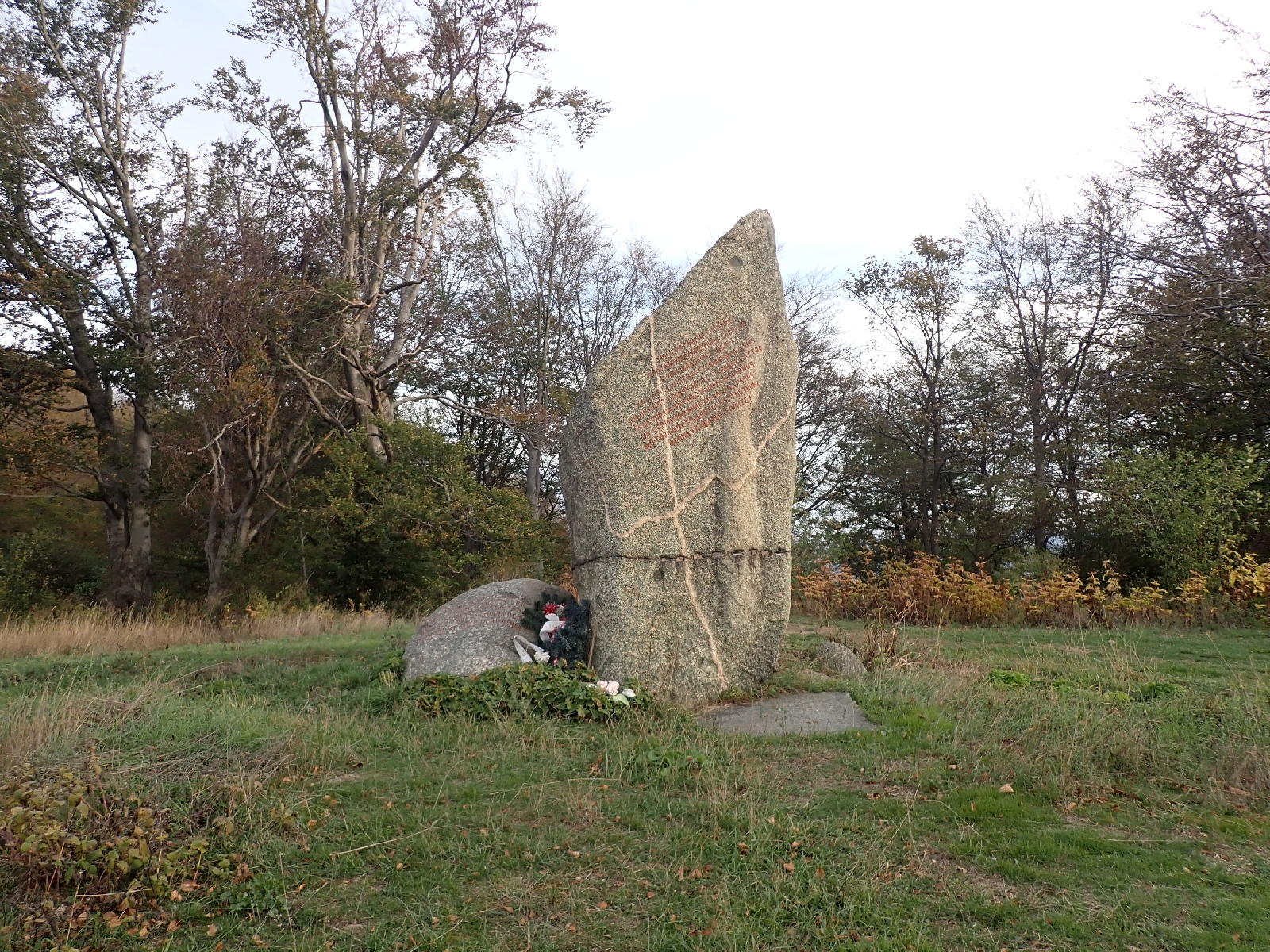
After packing up my tent, I walked to the first tourist site of the day at Aglikina Polyana. In this small clearing in the woods there was a monument consisting of a block of granite with words inscribed on it. It commemorated the rebels who fought the occupying Turks in the 19th century. This was the place where a rebel government was to be announced, but the insurrection failed, and the 14 rebels who gathered here were captured and killed. There was a small, white shrine nearby with icons inside. I sat on its steps and munched on some breakfast thinking how the stories of the fight against the Turks shaped the national identity. 

Monument to rebels at Aglikina Polyana.

There were many hills to climb up and down today as I walked through the endless forest. Until the final peak of Chumerna there were not really any milestones to break up the day. I stopped at a covered picnic table to eat half a bar of chocolate for elevenses, and ate the other half for lunch. There were a few limited views of adjacent forested hills and a group of horses. I took several photos of the tree lined track, magnificent beech trees, rising to the sky, and that was about it.

Beech trees rising into the sky.

The final climb to Chumerna summit was steep and tiring, but the reward was a summit area free of trees from which I could at last admire a view of distant mountain ranges, melting into the mist. The Danube plain was indistinct in the haze to the north. There were a group of abandoned buildings, once a military installation. The main compound had a few barking dogs in it.

View from Chumerna Summit (1536 metres).

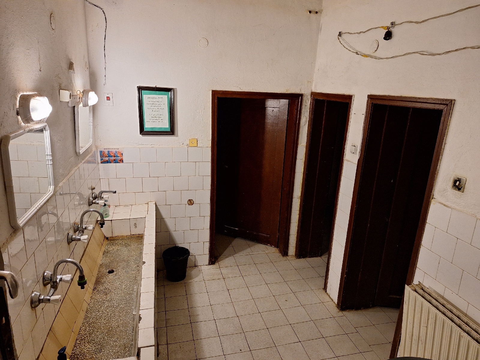
Chumerna hut dated from Soviet times with unchanged fittings and would benefit from extra cleaning in places. In contrast to its chunky, old fashioned features, with a few modern grey plastic pipes looking like a DIY addition, it does have WiFi! The man in charge was not expecting me despite Lyuben from Bulguides having booked for me. Consequently dinner was whatever was in the bottom of the pan which was "боб", or in English "beans", served as soup. Still not much alternative, at least none volunteered. I noticed the men's toilet was a squat type but the ladies has a sit down loo. Something to consider in the morning.

Bathroom in Chumerna Hut.

24.6 kilometres walked and over 1300 metres of ascent.
Thursday, October 10, 2024

E3: Kotel to Vratnik Pass: Day 9

Clear waymarked trails and a length of open grassland with views (a change from trees)!

I despaired as I tried to get everything into my rucksack to leave the hotel this morning. So much of my stuff is for temperatures down to freezing, yet my days have been in the twenties. Today was no exception with the sun shining I wished I had a broad rimmed sunhat to protect my face from the sun, whereas I had a woollen one to keep my ears warm in the cold.

Following my rest day I managed the first four kilometres of hill climbing without much trouble. Waymarking was good today, red and white stripes appearing on a tree on almost every occasion I reached for my GPS to check I was going the right way. There was only one junction lost in undergrowth, and two fallen trees to negotiate. After walking through woodland for a couple of hours I reached open pasture. The rough grassland made a welcome change from the trees of the past few days and I appreciated the views. A flock of sheep, some brown, others white, were also enjoying the grass, guided from the rear by a elderly shepherdess. All had ear tags in a responsible EU regulation manner. A few sheep had bells around their necks so I knew they were on the way and cautiously stood to one side prepared for an aggressive sheepdog that never appeared. Later I met another flock coming down the track. The shepherd tried to tell me something, I sensed it was that the way I was going did not lead anywhere, which it did not for many miles.

Open grassland for a change.

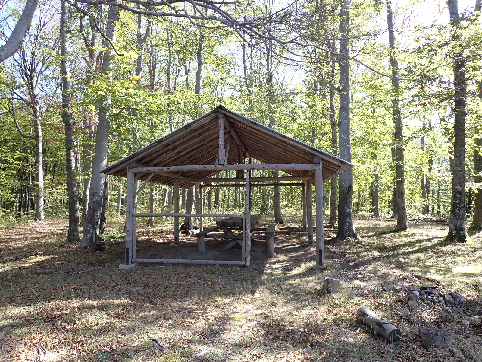
One of many sheltered picnic tables on the Kom-Emine.

After lunch at one of the covered picnic tables that dot the Kom-Emine trail, it was back into woodland, although the tall beech trees I walked through for most of the afternoon had much to recommend them. They looked especially attractive as shafts of light caught their leaves, highlighting their colour against a background in shadow. I also liked to crunch the beech mast under my feet. One thing I disliked was the way the track went up and down. It broadly followed the top of a ridge line but that meant it would climb then descend, climb then descend, in a repeated pattern. Rather tiring and tedious, especially as the trees were hiding a panorama that I could occasionally glimpse between the trunks to my right. 

An area of mature beech trees,

As the guidebook warned of ticks on today's stage, I had tucked my trousers into my socks so they could not climb up my legs. Flies were an irritant, buzzing around me, in addition to normal flies there were small, reddish brown flies, one got into my mouth, most unpleasant. But what puzzled me were tiny creatures that I thought initially were juvenile ticks, but that made no sense as they were arriving on top of me, then I thought small spiders. However on looking closely at one I had not squashed I saw they had tiny wings, maybe flying ants.

There were numerous forms of fungi to admire. Toadstool types rising from the ground, large and small bracket forms eating up fallen trees. All dirty creams or browns though, no red or orange types that I have yet seen.

Toadstool.

On route I spotted a large granite boulder, cut and polished and inscribed with words, a date and an image of two antique pistols. According to Google Translate it marked where a hero died in 1876 in a battle with the "Turkish enslavers". 

Kamchia River Spring sounded like important town in America, but was actually a trickle of water from a "fountain". However I needed the water, the day had been hot, my mouth dry, so I had drunk a fair amount and would soon be looking for a spot to camp, so I needed more for the night. I had spare in a Platypus bag but I might need that tomorrow. So I waited a while for the trickle to fill my water bottle. Then I ignored the Vratnik emergency shelter (the guidebook referred to bad hygienic conditions) and walked down the tarmac road nearby (the guidebook said the official trail was overgrown). I had intended to camp at Aglikina Polyana (an area recommended by the guidebook) but I worked out it would be dark by the time I reached it. Owing to breakfast at the hotel not starting until 8 am, I had a relatively late start. Consequently I found a flat spot under the beech trees, reasonably free of brambles, and pitched up for the night.

31.4 kilometres walked today and a total ascent of almost 1300 metres.

Wednesday, October 9, 2024

E3: Kotel rest day: Day 8

A day of rest, planning, shopping and discovering the history of a Bulgarian revolutionary. 

I spent much of the morning in thought: what to have for breakfast; where to stay for the next few nights given distances and elevation gains between huts, whether I could discard anything to reduce my rucksack's weight and how much food to buy. Then I walked into the centre of town. My morning coffee was in the cobbled, main square, where people were sitting chatting under two large trees long after they had finished their drinks.

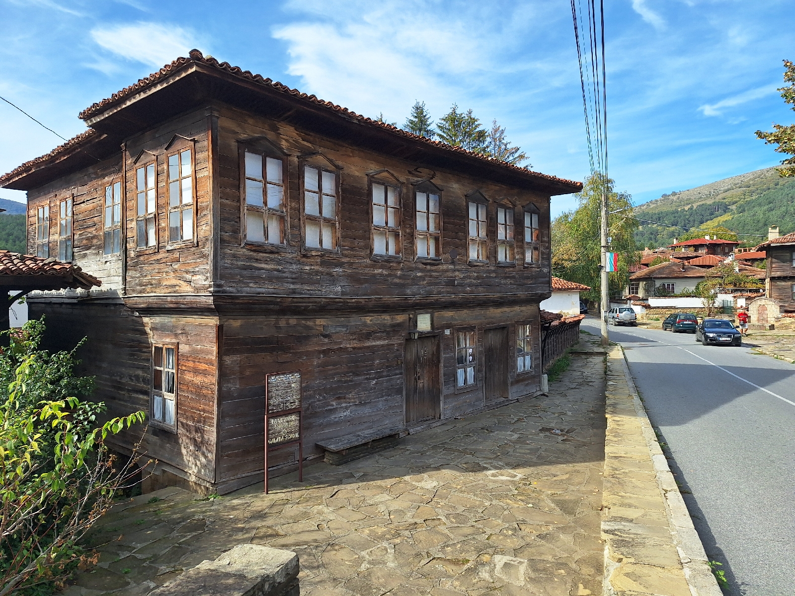
The higgledy piggledy arrangement of streets marked Kotel as a town of ancient foundation. I particularly admired the few remaining old, brown, wooden buildings. A revolutionary called Georgi Sava Rakovski was born in the town and a mural, museum, statue and numerous banners celebrated this fact using an image of him with a drooping moustache. Bulgaria was occupied by the Ottoman Turks from 1396, but in the 19th century there was a revival of Bulgarian national feeling, and a series of failed insurrections against the Turks. Rakovski was one of those agitating for independence, particularly through his literary work. A novel I am reading called "Under the Yoke" by Ivan Vazov is also set in this period of unsuccessful attempts to throw off Ottoman imperialism.  It was written in 1888 not long after Bulgaria finally gained its independence in 1878 thanks to Russia. I visited the Historical Museum beside the main square which is also the mausoleum of Radovski. Although it's main focus is the fight for statehood in the 19th century there are an eclectic collection of other historical items including Sumerian clay tablets from thousands of years BC, a preserved heart of some important person and a reproduction of a school room. The collection of early books in Bulgarian and an ancient printing press was perhaps more relevant to the rise in Bulgarian national feeling. The Orthodox Church was a means of maintaining Bulgarian identity during the years of rule by the Muslim Turks. I visited two of the churches, similar in style with pale blue ceilings and white columns. The iconostasis in an Orthodox Church separates the congregation from the alter and carries icons of Christ, the Virgin Mary and numerous saints. In the church of St Peter and Paul it was a delicately carved wooden structure.

This old building is actually a museum, although I did not visit it.

After a relaxing afternoon, a walk in the park by my hotel, which also has memorials to what I assume were 19th century revolutionaries, I ate dinner in the hotel's restaurant. I thought there might be a singer, they set up for one, but maybe they decided against it as I was the only diner. October seems a quiet period...


Prague and return home: Day 184 &5

An informative day spent seeing Prague, followed by my return home. I joined a walking tour of Prague this morning (feeling that...